|
|
|
|
Back to MOAB, UTAH:
ARCHES and CANYONLANDS NATIONAL PARKS
2005 April 16-18
|
|
|
|
|
You should check out this page
because it has a whole bunch
of really great pictures
from the Canyonlands area in Utah.
You probably don't care about my personal experience
flying there or hiking there
unless you know me personally.
But, no matter what,
the pictures are really great,
so enjoy them.
 My previous trip was to Zion,
Bryce Canyon was covered with snow,
and
my
last trip
to Moab, Canyonlands, Arches, and Dead Horse Point
left me yearning for more.
(The last trip page
is one of my better web pages
and has some great pictures.
I strongly recommend it.)
My first trip to Canyonlands was myriad parking-lot viewpoints,
short hikes, and two running-path views.
My previous trip was to Zion,
Bryce Canyon was covered with snow,
and
my
last trip
to Moab, Canyonlands, Arches, and Dead Horse Point
left me yearning for more.
(The last trip page
is one of my better web pages
and has some great pictures.
I strongly recommend it.)
My first trip to Canyonlands was myriad parking-lot viewpoints,
short hikes, and two running-path views.
About a week before the trip I checked the weather forecasts, decided to go, called the hotel and rental-car, e-mailed Redtail Aviation at Canyonlands Airport (CNY) to make sure there were no airport-related issues, arranged to take Monday off from work, and was all set to enjoy my three-day, aviation-adventure weekend. That's one thing I really love about being in Arizona as I couldn't have that spontaneity from any of the other places I have lived.
 The
book
I was reading
(Exploring Canyonland & Arches National Parks,
a Hiking and Backcountry Driving Guide by Bill Schneider)
mentioned several seriously longer hikes.
Some were multi-day backpacking journeys
that didn't tempt me —
my idea of camping out is a hotel room
with black-and-white television and no cable —
but there were some full-day adventures that beckoned.
Two of them seemed within my ability,
maybe close to my limit,
the Lathrop and Murphy trails.
The
book
I was reading
(Exploring Canyonland & Arches National Parks,
a Hiking and Backcountry Driving Guide by Bill Schneider)
mentioned several seriously longer hikes.
Some were multi-day backpacking journeys
that didn't tempt me —
my idea of camping out is a hotel room
with black-and-white television and no cable —
but there were some full-day adventures that beckoned.
Two of them seemed within my ability,
maybe close to my limit,
the Lathrop and Murphy trails.
Two reasons pushed me to Lathrop over Murphy, a gentler, less-scary descent and being able to go past the white rim all the way to the Colorado River. While hiking twenty miles (round trip) is not within my comfort zone, nor running twenty miles, about half this route is within my running ability while the other half is definitely hiking terrain. So long as I don't get hurt or run out of water, I can hike ten and run ten.
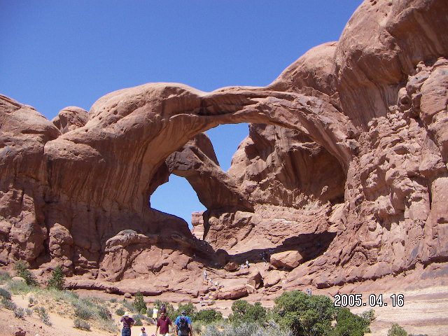
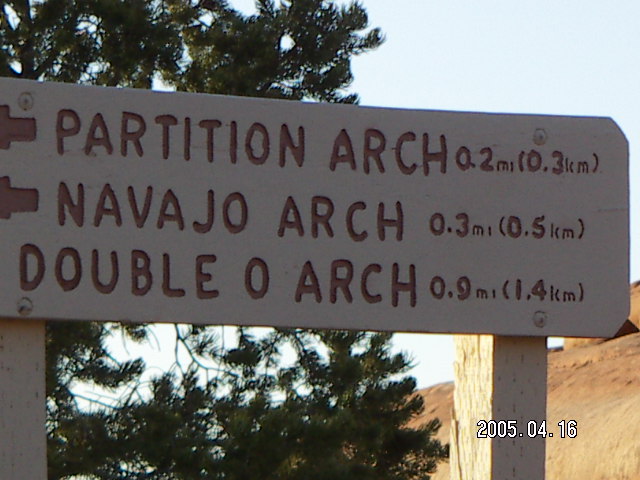
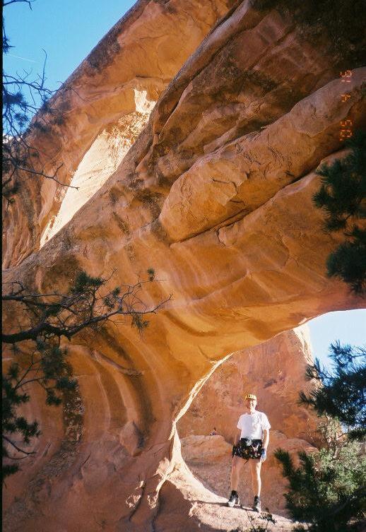
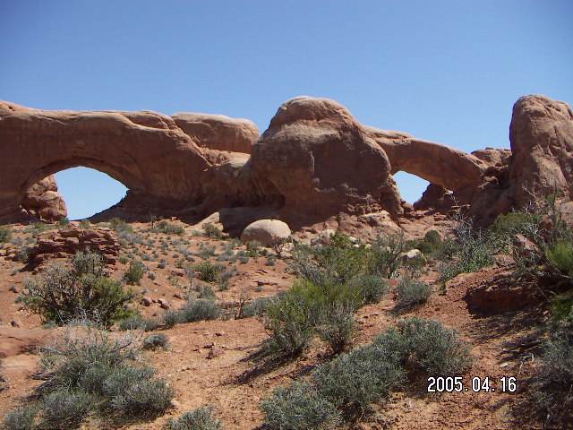
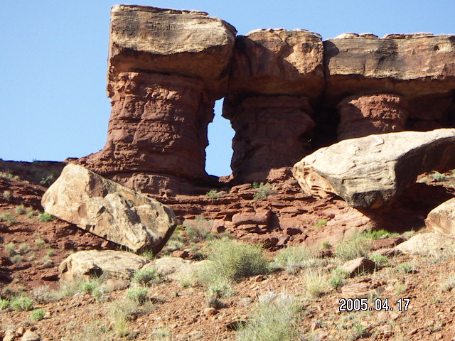
The Windows is a pair of arches,
a spectacle that looks like spectacles
complete with a giant nose between the arch-eyes.
Photographs I have seen do not convey their large size
and the brief, quiet, so-called primitive trail
behind them was a serene joy to hike.
There is also a double arch at the same parking stop.
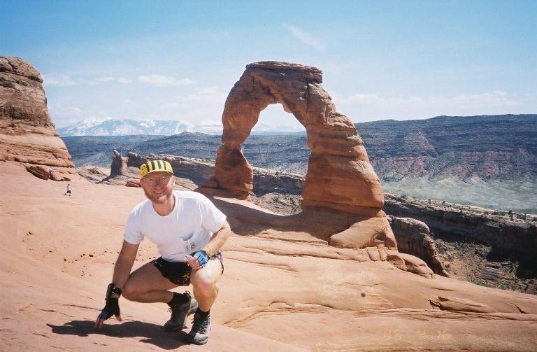
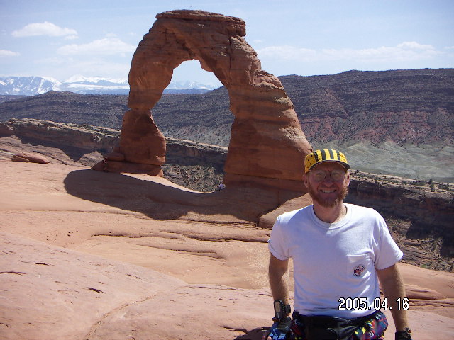
I did the mandatory Delicate Arch hike
which was steep, crowded, and beautiful.
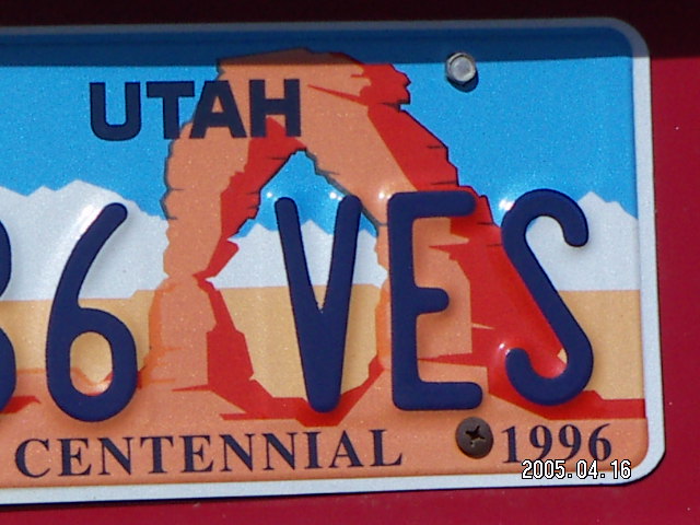
Delicate Arch is the symbol
of Arches National Park in particular
and of the state of Utah on their car license plates.
Like the Windows, it's larger than it looks in pictures.
It doesn't look particularly delicate to my eye,
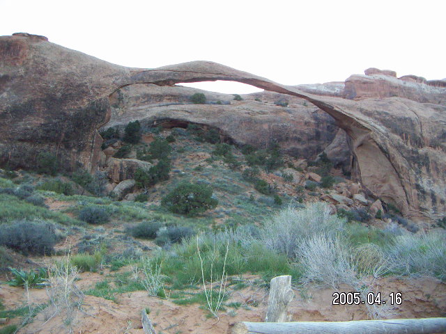
far less fragile than Landscape Arch,
but that's the name it has been given.
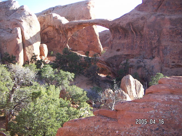
My Arches National Park day ended
with the park's longest hike from the last parking lot
to Devil's Garden via
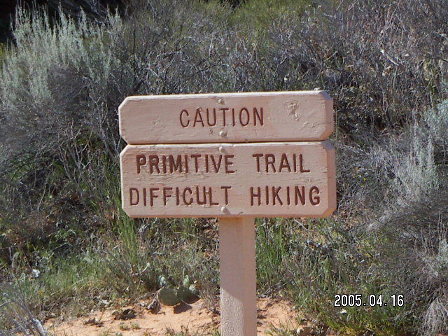
the so-called Primitive trail,
decidedly more rugged than the regular trail,
but within even my meager clambering ability.
When I was done, I was comfortably thirsty,
HHI=six (Hiking Hydration Index),
so I drank a lot of water after the hike,
with dinner,
and when I got up throughout the night.
I wanted to be well hydrated for the next day's mega-effort.
According to my Garmin Forerunner 201
wrist-GPS gizmo,
my Arches day totaled 22.5 Km (14 miles),
wonderful views near, far, and in-between.
I'm also approaching this as an athlete.
Twenty miles is a serious effort,
longer than rim-to-rim in the
Grand Canyon
with half the elevation change.
The fourth mile out has more than half of it.
I figure I can't hike twenty miles,
I can't run twenty miles (in my current shape),
but I can hike ten and run ten.
The first two miles to the canyon rim
and the last four miles of jeep road
from the white rim to the Colorado River
should be run-able
even for somebody who isn't a trail runner.
The first human beings I saw on my Lathrop trek,
actually the first mammals of any kind,
were two bicyclists on the white rim road
who expressed surprise seeing someone so early, around 9:00.
By leaving at first light and running three of the six miles,
I expect I was one of the earliest people
reaching that intersection down the trail.
These was the last company I met until four hours later.
By mile sixteen I finished my last water
at HHI=four
and hoped I would make it home
without getting much thirstier.
It was 25° C. (80° F.),
not hot but warm enough to dry me out
especially with the major climb still ahead of me.
Near the end of the big-climb next mile
I had some nausea and had to wait a few minutes
at HHI=two.
I saw my next and last human company,
two women who had enough extra water to give me half a liter,
a badly-needed infusion of bodily fluids.
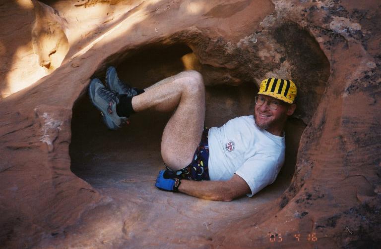
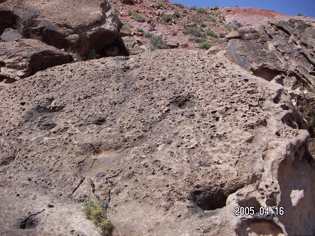
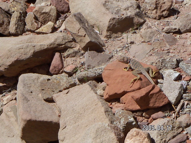
(Check out the lizard in the picture on the left.
This rocky stuff was the trail terrain for the steepest mile.)
When I called the Flight Service Station
in Ceder City, Utah,
at 7:00 to check the weather,
they told me there was a notice
that the Canyonlands Airport (CNY) runway would be closed
for runway painting
all day starting at 8:00.
The airport confirmed the impending closure,
the one they didn't tell me about when
I e-mailed and called them planning the trip
and when I arrived Saturday.
Maybe some people at the airport
didn't know what work other people were planning,
but it meant I had an hour to get myself flying out.
There is a short, dirt runway I would be able to use,
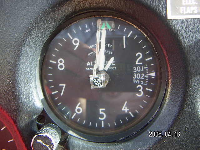
but I prefer a long, paved runway at this higher altitude
(4600 feet, 1400 meters, 850 millibars),
especially when I'm not feeling my best.
How did I run out of water so easily?
After all,
I have done twenty-mile runs in weather this warm
(25° C., 80° F.)
without supplemental water and without any problem.
I take supplemental water and sports drinks
when I run marathons
and I'm still dehydrated enough to degrade athletic performance
but I'm never dehydrated enough to get sick.
I think the big difference between then and now
is that I was out there for a long time, eight hours,
perspiring and breathing all that time.
Also, I suspect the previous day's effort
left me water-depleted without realizing it.
Six days later I went to an
Arizona-Pilots-Association
meeting at Pasyon Airport (PAN)
with a presentation on survival skills.
According to our speaker,
Tony Nester,
assuming I understood him correctly,
most of the people who get stuck in survival situations
die because they give up
and decide they don't have the strength to pursue their own survival.
Also, those that do find the will to survive
have a strong belief in some
higher power.
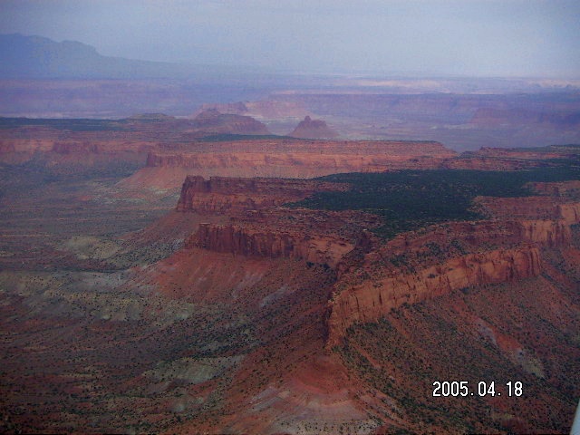
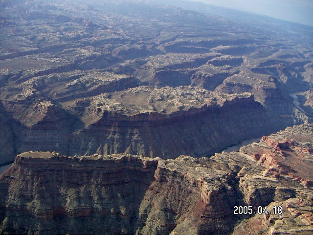
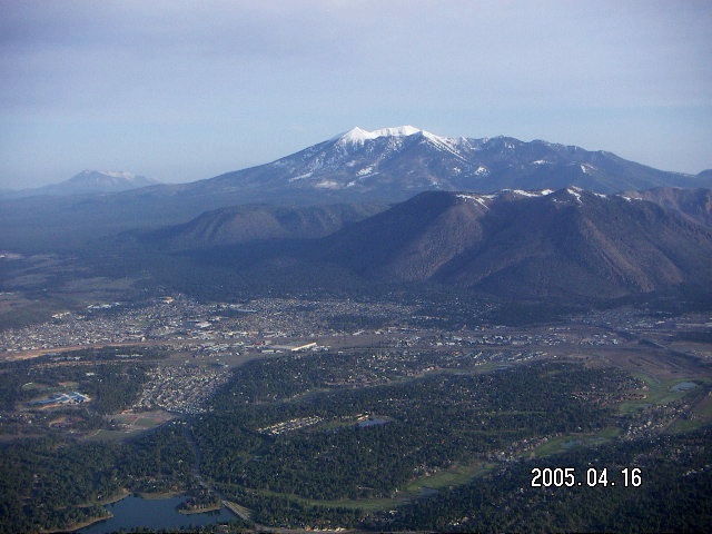
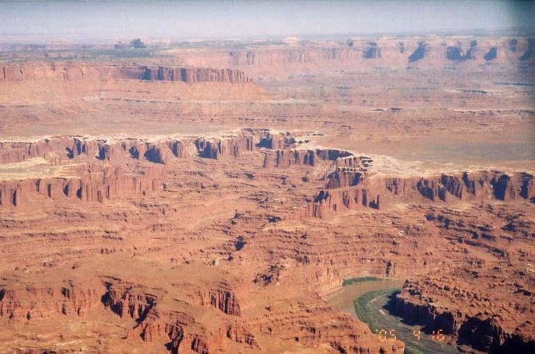 The route of flight is pretty basic,
same as last trip but with new
pictures
in the links,
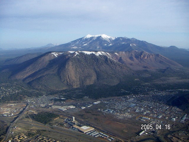
from Deer Valley Airport (DVT) in Phoenix to Flagstaff
past Humphries Peak,
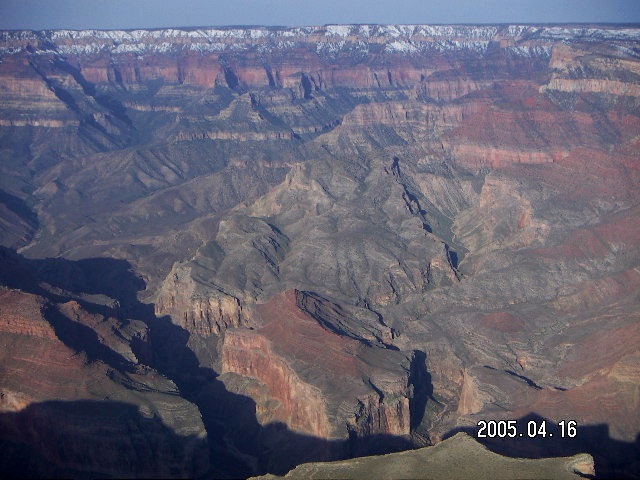
over the Painted Desert
with a detour over the east end of the
Grand Canyon,
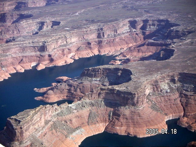
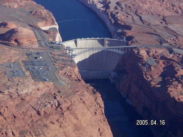
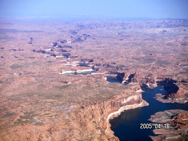
to Page,
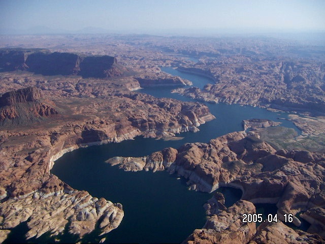
along Lake Powell
(map),
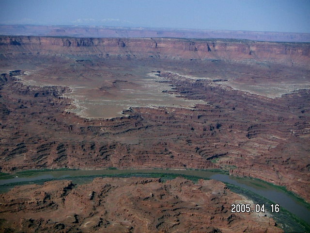
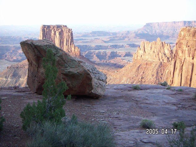
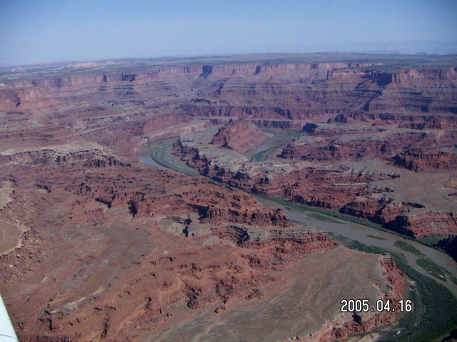
over
Canyonlands National Park,
left turn over Moab,
eighteen miles flying over U.S. Route 191,
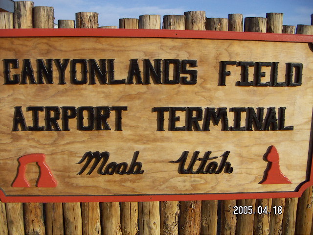
and into
Canyonlands Airport
(CNY).
Other than three and a half flying hours
over beautiful terrain
with perfect weather and a tailwind,
there isn't much to say about the trip.
The route of flight is pretty basic,
same as last trip but with new
pictures
in the links,
from Deer Valley Airport (DVT) in Phoenix to Flagstaff
past Humphries Peak,
over the Painted Desert
with a detour over the east end of the
Grand Canyon,
to Page,
along Lake Powell
(map),
over
Canyonlands National Park,
left turn over Moab,
eighteen miles flying over U.S. Route 191,
and into
Canyonlands Airport
(CNY).
Other than three and a half flying hours
over beautiful terrain
with perfect weather and a tailwind,
there isn't much to say about the trip.
 Since Arches got the short end of last trip's weather woes,
I decided to visit it first this time
(more pictures)
and to save the long hike for my full day.
Arches is not a hiker's paradise,
it is a park of short strolls to popular views
filled with noisy children during the popular time
which, alas, includes April.
There are two classes of noisy children,
those seeing how loud they can yell
in a place where others came to seek serenity
and those
whining, sobbing, sniveling, and crying
at their misfortune being in such a terrible place
forced to be with their families.
I found some of the viewpoints
had slightly-longer and less-popular hikes,
the trails not taken (apology to Robert Frost).
Since Arches got the short end of last trip's weather woes,
I decided to visit it first this time
(more pictures)
and to save the long hike for my full day.
Arches is not a hiker's paradise,
it is a park of short strolls to popular views
filled with noisy children during the popular time
which, alas, includes April.
There are two classes of noisy children,
those seeing how loud they can yell
in a place where others came to seek serenity
and those
whining, sobbing, sniveling, and crying
at their misfortune being in such a terrible place
forced to be with their families.
I found some of the viewpoints
had slightly-longer and less-popular hikes,
the trails not taken (apology to Robert Frost).
 Once I got my airplane secured for its two-day stay at CNY
I drove to Arches
and started visiting popular viewpoints.
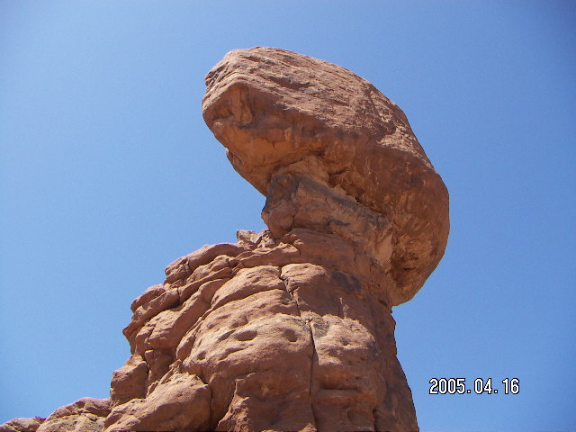
The first was Balanced Rock,
a well-known, popular-photograph monument
with a noisy, crowded trail
and a quiet path on the other side.
Apparently the hard rock on top resisted erosive forces
that removed much of the softer rock underneath
resulting in a striking display.
Once I got my airplane secured for its two-day stay at CNY
I drove to Arches
and started visiting popular viewpoints.
The first was Balanced Rock,
a well-known, popular-photograph monument
with a noisy, crowded trail
and a quiet path on the other side.
Apparently the hard rock on top resisted erosive forces
that removed much of the softer rock underneath
resulting in a striking display.
 At the Garden of Eden stop
I noticed some specks of color on a rock pillar
that turned out to be
climbers
when I looked more closely.
There are many ways to enjoy these formations.
At the Garden of Eden stop
I noticed some specks of color on a rock pillar
that turned out to be
climbers
when I looked more closely.
There are many ways to enjoy these formations.
 On the subject of names,
Arches and Canyonlands seem to be relatively free
of mythological names.
It seems most parks I visit have Vulcan's Throne
or Thor's Hammer or Ulysses's Bow
or Neptune's Commode or
two pointed peaks called Hera's
[maybe we better not go there].
On the subject of names,
Arches and Canyonlands seem to be relatively free
of mythological names.
It seems most parks I visit have Vulcan's Throne
or Thor's Hammer or Ulysses's Bow
or Neptune's Commode or
two pointed peaks called Hera's
[maybe we better not go there].

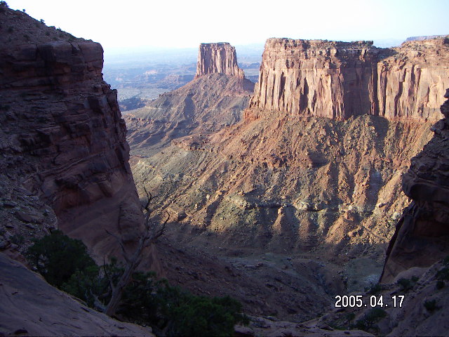
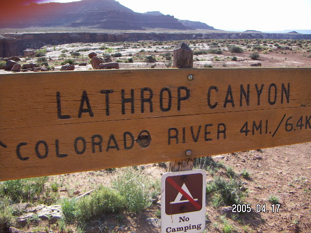
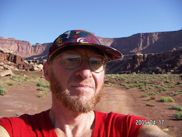 Today is IT, the Great Big Effort,
the Lathrop trail,
a chance to see the white rim up close,
all the way to the Colorado River
if I'm up to it
(more pictures).
One guide book says it's eighteen miles round trip
while another says twenty-one,
all sources seem to agree that it's
about 2500 feet (800 meters) drop to the river
with the same climb coming back.
It's 6:00, oh-six-hundred in the morning,
my body is fully charged
HHI=eleven
with two water bottles strapped on,
my digital camera's batteries are fully charged,
and my wrist-worn GPS is fully charged.
I'm ready to go.
Today is IT, the Great Big Effort,
the Lathrop trail,
a chance to see the white rim up close,
all the way to the Colorado River
if I'm up to it
(more pictures).
One guide book says it's eighteen miles round trip
while another says twenty-one,
all sources seem to agree that it's
about 2500 feet (800 meters) drop to the river
with the same climb coming back.
It's 6:00, oh-six-hundred in the morning,
my body is fully charged
HHI=eleven
with two water bottles strapped on,
my digital camera's batteries are fully charged,
and my wrist-worn GPS is fully charged.
I'm ready to go.
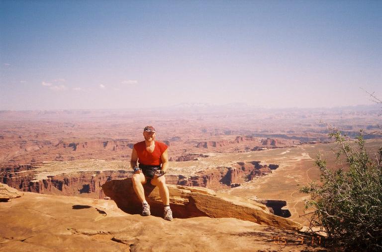
 I'm approaching this as a vista viewer.
Last time I got to the canyon rim on this trail
and the view was spectacular beckoning me to go further.
On that day, I had just enough time
to run energetically back to the road
and to drive to see the sunset,
but I wanted to come back to see more of this trail.
Now I'm finally going to do it.
I'm approaching this as a vista viewer.
Last time I got to the canyon rim on this trail
and the view was spectacular beckoning me to go further.
On that day, I had just enough time
to run energetically back to the road
and to drive to see the sunset,
but I wanted to come back to see more of this trail.
Now I'm finally going to do it.
 This is scary for me like any athletic event.
I'm expecting the physical challenge to be serious.
While I might run the last two miles full of spirit,
on my way back
I might reach the bottom of the big-climb mile
exhausted and thirsty with four miles to go.
Also, I'm concerned that the steep mile may have footing
beyond my ability to hike.
For that concern,
descending is scarier and more limiting,
so I'm not likely to get "trapped" in a hiking situation
outside my agility limits.
This is scary for me like any athletic event.
I'm expecting the physical challenge to be serious.
While I might run the last two miles full of spirit,
on my way back
I might reach the bottom of the big-climb mile
exhausted and thirsty with four miles to go.
Also, I'm concerned that the steep mile may have footing
beyond my ability to hike.
For that concern,
descending is scarier and more limiting,
so I'm not likely to get "trapped" in a hiking situation
outside my agility limits.
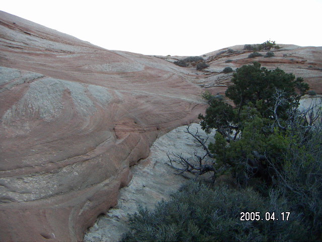
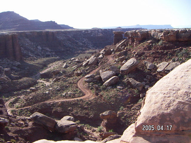
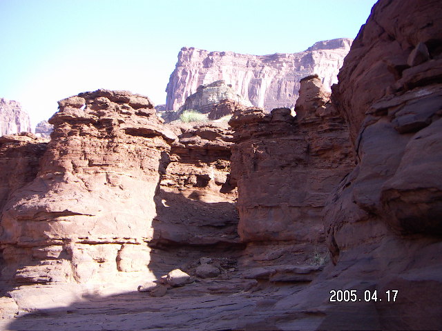
 The trip down to the white rim
was every bit as spectacular and wonderful
as any guide book would have you believe.
View after view, vista after vista, drew me further along the trail.
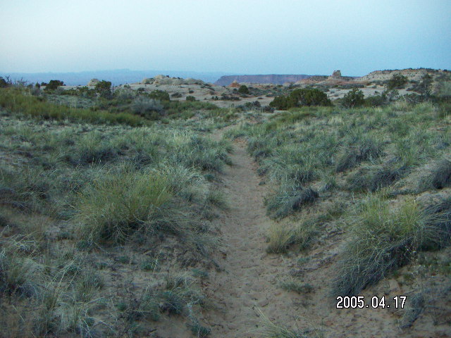
The first mile is a dirt-and-sand trail cut through the grass,
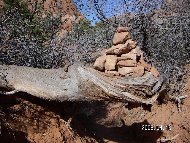
the second mile is slickrock with
rock cairns
to mark the way,
and I was able to run almost all of this part.
The third mile is pleasant canyon-rim trail hiking of gentle descent
and the fourth mile is steep and rocky switchbacks
with rock stairs put in for the difficult parts.
There was no time I was clambering over scary ledges
or descending into places where a fall
would have been over a high cliff.
The trip down to the white rim
was every bit as spectacular and wonderful
as any guide book would have you believe.
View after view, vista after vista, drew me further along the trail.
The first mile is a dirt-and-sand trail cut through the grass,
the second mile is slickrock with
rock cairns
to mark the way,
and I was able to run almost all of this part.
The third mile is pleasant canyon-rim trail hiking of gentle descent
and the fourth mile is steep and rocky switchbacks
with rock stairs put in for the difficult parts.
There was no time I was clambering over scary ledges
or descending into places where a fall
would have been over a high cliff.
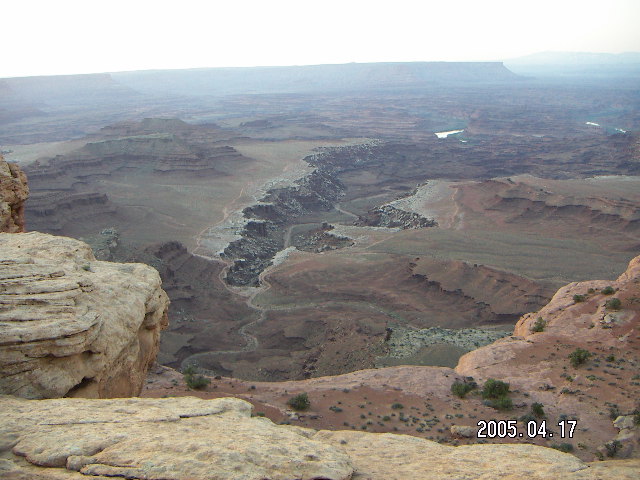
 The fifth mile runs through small canyons
and spends some of its length on a gentle ridge
between two canyons, quite a striking view,
and the sixth mile goes along a wash to the white rim road.
The sign at the top says it's five miles to this road
while
the sign here says it's seven miles back up to the top.
Maybe they were counting
descending and climbing distance differently
on the same trail.
The fifth mile runs through small canyons
and spends some of its length on a gentle ridge
between two canyons, quite a striking view,
and the sixth mile goes along a wash to the white rim road.
The sign at the top says it's five miles to this road
while
the sign here says it's seven miles back up to the top.
Maybe they were counting
descending and climbing distance differently
on the same trail.
 I turned right on the white rim road
for about a furlong (200 meters)
and turned left onto the jeep road
down to the Colorado River.
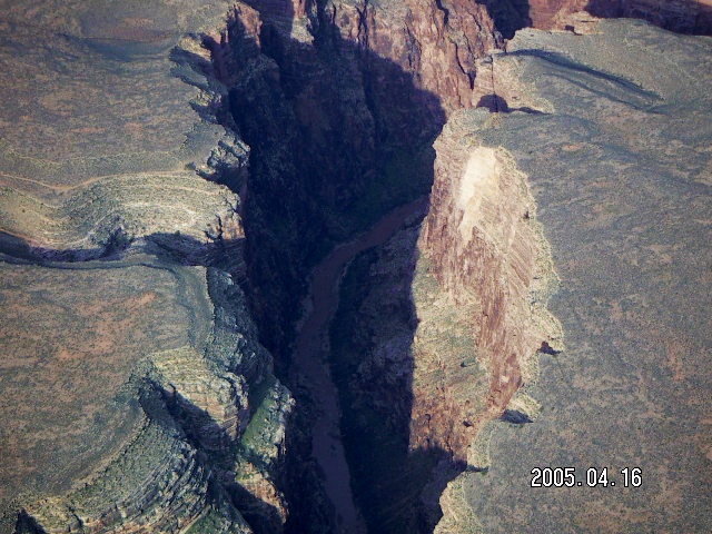
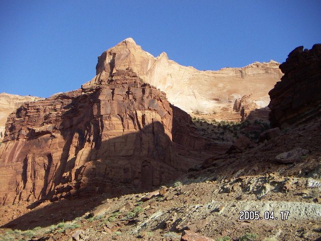
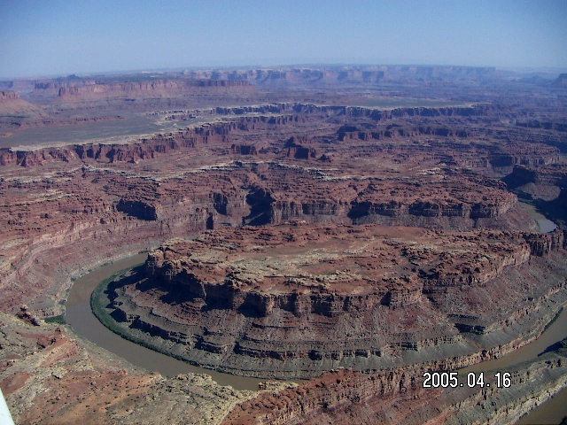
The white rim is a layer of hard, white rock
that has resisted erosion more than the layers beneath.
From above this creates the wonderful shapes of the white rim.
From up close the white rim itself is a ragged edge
of large, white rocks falling into the canyon.
Sometimes the hard, white rock sits on top of
columns of softer, brown rock to form mushroom formations.
I turned right on the white rim road
for about a furlong (200 meters)
and turned left onto the jeep road
down to the Colorado River.
The white rim is a layer of hard, white rock
that has resisted erosion more than the layers beneath.
From above this creates the wonderful shapes of the white rim.
From up close the white rim itself is a ragged edge
of large, white rocks falling into the canyon.
Sometimes the hard, white rock sits on top of
columns of softer, brown rock to form mushroom formations.
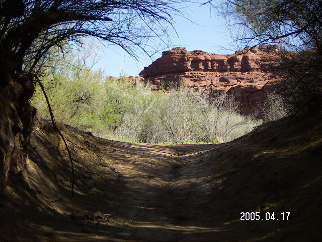 The last four miles to the Colorado River
is a pleasant run along the jeep road,
eight miles round trip.
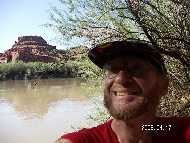
At the end of the jeep road is a riverside picnic area
with an outhouse.
Sitting on a picnic bench at a table,
I nibbled on my second Power Bar of the day.
My water bottles strapped to me were still full
and my internal system was at
HHI=eight.
My GPS read 10.0 miles even,
so I knew my total trip would be 20 miles (32 Km).
(I had my GPS in traditional units, miles and feet,
instead of metric
because the signs and maps were in those units.)
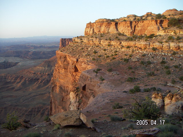
Running back up the road gave me a good look
at the climb back up to the
Island in the Sky
part of Canyonlands National Park
where the Lathrop Trail starts.
The last four miles to the Colorado River
is a pleasant run along the jeep road,
eight miles round trip.
At the end of the jeep road is a riverside picnic area
with an outhouse.
Sitting on a picnic bench at a table,
I nibbled on my second Power Bar of the day.
My water bottles strapped to me were still full
and my internal system was at
HHI=eight.
My GPS read 10.0 miles even,
so I knew my total trip would be 20 miles (32 Km).
(I had my GPS in traditional units, miles and feet,
instead of metric
because the signs and maps were in those units.)
Running back up the road gave me a good look
at the climb back up to the
Island in the Sky
part of Canyonlands National Park
where the Lathrop Trail starts.
 The run back up the road was pleasant, uphill, and a bit tiring.
At HHI=six I drank my first water bottle.
After the zig-zag on the white rim road
the path back up was comfortingly familiar
and the reverse-direction views are lovely.
The run back up the road was pleasant, uphill, and a bit tiring.
At HHI=six I drank my first water bottle.
After the zig-zag on the white rim road
the path back up was comfortingly familiar
and the reverse-direction views are lovely.
 With a cool breeze,
I figured my enemy was time rather than effort.
Running may use more water per unit time in sweat,
but it uses less water per unit distance than hiking
because of the shorter time exposure.
Tired and thirsty as I was,
I figured I was better off running
rather than hiking
the last two miles
back to the Lathrop trailhead.
Also, my legs and feet were sore from hiking
but felt much better running.
With a cool breeze,
I figured my enemy was time rather than effort.
Running may use more water per unit time in sweat,
but it uses less water per unit distance than hiking
because of the shorter time exposure.
Tired and thirsty as I was,
I figured I was better off running
rather than hiking
the last two miles
back to the Lathrop trailhead.
Also, my legs and feet were sore from hiking
but felt much better running.
 The rangers at the Canyonlands Visitor Center
told me I had heat exhaustion
and assured me that I would be better soon,
maybe a few hours, maybe a few days.
I spent the night not feeling well
and decided I would skip Dead Horse Point this trip.
The rangers at the Canyonlands Visitor Center
told me I had heat exhaustion
and assured me that I would be better soon,
maybe a few hours, maybe a few days.
I spent the night not feeling well
and decided I would skip Dead Horse Point this trip.
 The flight home from Moab to Phoenix was beautiful,
the same beautiful as the way here in reverse,
only a few bumps along the way.
I was surprised how smooth the ride was
considering that it was windy.
Usually mountain passes are bumpy on windy days,
a lot of turbulence, eddies and rotors in the sky.
There were a few of these moments on the trip,
but most of the route was smooth air.
The flight home from Moab to Phoenix was beautiful,
the same beautiful as the way here in reverse,
only a few bumps along the way.
I was surprised how smooth the ride was
considering that it was windy.
Usually mountain passes are bumpy on windy days,
a lot of turbulence, eddies and rotors in the sky.
There were a few of these moments on the trip,
but most of the route was smooth air.
 I plan to return to Arches and
I would like to run and hike the Lathrop trail again,
next time with enough water.
I plan to return to Arches and
I would like to run and hike the Lathrop trail again,
next time with enough water.
 As for the near death experience
of finding myself dehydrated and heat-exhausted
with three miles (5 Km) to go and
a thousand feet (300 meters) to climb,
it occurred to me that I might not make it,
but it never occurred to me to behave that way.
I did whatever would maximize my chance of making it back
with minimum ill effects afterward.
(I suspect I wasn't all that near to death's door,
just feeling lousy enough to learn a lesson for next time.)
As for the near death experience
of finding myself dehydrated and heat-exhausted
with three miles (5 Km) to go and
a thousand feet (300 meters) to climb,
it occurred to me that I might not make it,
but it never occurred to me to behave that way.
I did whatever would maximize my chance of making it back
with minimum ill effects afterward.
(I suspect I wasn't all that near to death's door,
just feeling lousy enough to learn a lesson for next time.)
 Let me assure all my friends
that I never considered help from any power higher than my own self.
There is a point in almost every race I have run,
usually about two-thirds of the way through,
where my body is telling me to let up
and I have to remind myself that
I'm going to have to get to the finish line
on my own efforts
and nobody but me is going to help me get there.
This case was reality instead of a running race,
but effort is effort, pain is pain,
and commitment is commitment.
Lessons learned on the cross country
running
course
are applicable elsewhere,
in lots of places in fact,
some mental, some emotional, and others physical.
Let me assure all my friends
that I never considered help from any power higher than my own self.
There is a point in almost every race I have run,
usually about two-thirds of the way through,
where my body is telling me to let up
and I have to remind myself that
I'm going to have to get to the finish line
on my own efforts
and nobody but me is going to help me get there.
This case was reality instead of a running race,
but effort is effort, pain is pain,
and commitment is commitment.
Lessons learned on the cross country
running
course
are applicable elsewhere,
in lots of places in fact,
some mental, some emotional, and others physical.
1:07:12 Mountain Standard Time
(MST).
18448 visits to this web page.