|
| ||
| |||
|
|
|
A Two-Day Bryce Canyon Trip
2008 October 25-26
|
|
| ||
|
| |||
|
|
|
|
 What makes a perfect weekend?
What combination of planned and unplanned
syzygy
does it take to make a perfect two-day interval?
For an aviator, runner, hiker, and general outdoors weenie
like myself,
it's a combination of altitude and attitude,
having the sky and my mood and everything else
all working right at the same time.
What makes a perfect weekend?
What combination of planned and unplanned
syzygy
does it take to make a perfect two-day interval?
For an aviator, runner, hiker, and general outdoors weenie
like myself,
it's a combination of altitude and attitude,
having the sky and my mood and everything else
all working right at the same time.
 Like a fine wine,
Bryce Canyon National Park is the kind of experience
where description is useful only to those who already know.
Oenophiles
have language within their circle about wine's
appearance, smell, taste, and aftertaste.
Little of that language helps anybody outside their circle
understand what makes wine a wonderful experience.
Similarly,
those who have never spent time savoring the outdoors,
particularly the magnificent rock formations of the desert,
aren't going to be transformed by a few well-chosen words
and some ooh-aah pictures.
Like a fine wine,
Bryce Canyon National Park is the kind of experience
where description is useful only to those who already know.
Oenophiles
have language within their circle about wine's
appearance, smell, taste, and aftertaste.
Little of that language helps anybody outside their circle
understand what makes wine a wonderful experience.
Similarly,
those who have never spent time savoring the outdoors,
particularly the magnificent rock formations of the desert,
aren't going to be transformed by a few well-chosen words
and some ooh-aah pictures.
This weekend had five parts, planning, flying, hiking, the night sky, and music. All were perfect this weekend, coming together like magic.

Planning
 Moving to Phoenix means being close to a beautiful part of the world.
There are some beautiful places right near Phoenix,
but my absolute favorite places are the national parks in Utah.
When I lived back east or in the midwest
going to these places was a great big adventure
involving airline flights, rental cars,
waiting in line with shoes off at airport security stations,
waiting in line with shoes on at rental car counter locations,
and lots of driving.
With my own airplane,
I can go to Bryce Canyon for the weekend,
leave
Saturday
morning,
hike all afternoon,
see sunset, stars, and sunrise,
hike all morning,
and return
Sunday
afternoon.
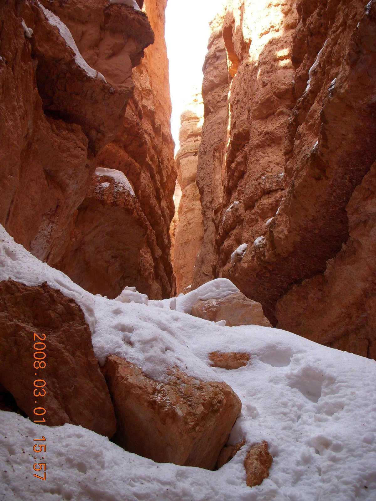
Last March when the trails were to icy at Zion I flew
from Zion to Bryce,
spent the afternoon
hiking in the snow,
stayed over until
the next morning,
and then
flew home.
Moving to Phoenix means being close to a beautiful part of the world.
There are some beautiful places right near Phoenix,
but my absolute favorite places are the national parks in Utah.
When I lived back east or in the midwest
going to these places was a great big adventure
involving airline flights, rental cars,
waiting in line with shoes off at airport security stations,
waiting in line with shoes on at rental car counter locations,
and lots of driving.
With my own airplane,
I can go to Bryce Canyon for the weekend,
leave
Saturday
morning,
hike all afternoon,
see sunset, stars, and sunrise,
hike all morning,
and return
Sunday
afternoon.
Last March when the trails were to icy at Zion I flew
from Zion to Bryce,
spent the afternoon
hiking in the snow,
stayed over until
the next morning,
and then
flew home.
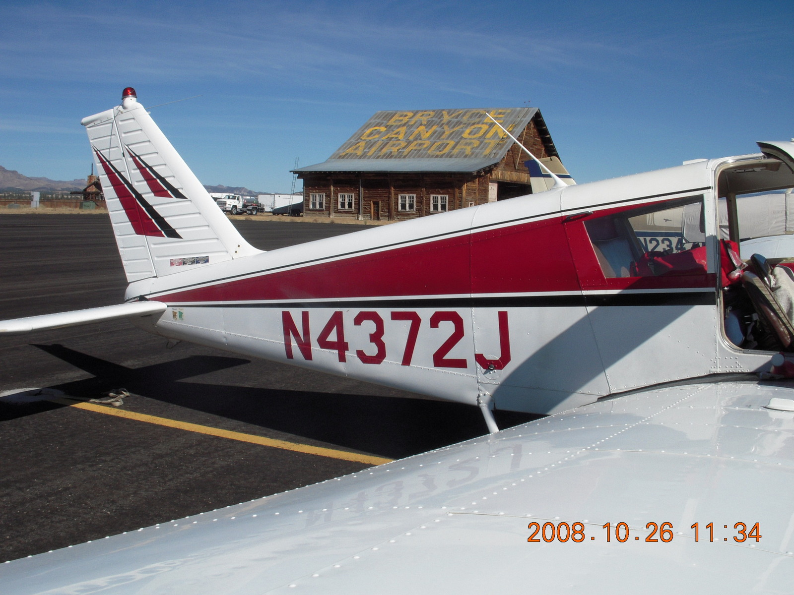
 Even at 120 miles per hour in my slow airplane,
a Piper Cherokee 140, model PA28-140,
I can get from Phoenix Deer Valley Airport
(DVT)
to Bryce Canyon Airport
(BCE)
in about three hours.
It's a stunning trip over beautiful Arizona mountains,
the Grand Canyon,
lunar-landscape scenery in Utah,
and Bryce Canyon itself.
In the fantasy version I just decide on Friday afternoon
to spend the weekend at Bryce Canyon,
just
hop
in the plane and go.
Even at 120 miles per hour in my slow airplane,
a Piper Cherokee 140, model PA28-140,
I can get from Phoenix Deer Valley Airport
(DVT)
to Bryce Canyon Airport
(BCE)
in about three hours.
It's a stunning trip over beautiful Arizona mountains,
the Grand Canyon,
lunar-landscape scenery in Utah,
and Bryce Canyon itself.
In the fantasy version I just decide on Friday afternoon
to spend the weekend at Bryce Canyon,
just
hop
in the plane and go.

|
|
|
 Finally, Bryce Canyon is getting more and more popular,
so the autumnal gap
between the last summer tourists and the first winter snow
is getting narrower and narrower,
down to a couple of weekends at the end of October.
I may be getting old,
but
I'm still a tough-enough endurance athlete
to do all the hiking I want to do
in two half-day sessions.
Queens Garden,
Peek-A-Boo loop,
Bryce Point,
Navajo loop,
and back up Queens Garden
with some strolling around the Bristlecone loop
make a nice eleven-mile first day (18 Km)
and
the rim trail,
Tower Bridge
and Fairyland
make a good eight-mile second day (13 Km).
After hiking nineteen hilly miles (31 Km)
my legs are tired and I'm ready to go home
to face another week of work.
I just hope I'm not too tired
to enjoy my front row tickets
for the piano recital concert
with
Michael Kim
Sunday night.
Finally, Bryce Canyon is getting more and more popular,
so the autumnal gap
between the last summer tourists and the first winter snow
is getting narrower and narrower,
down to a couple of weekends at the end of October.
I may be getting old,
but
I'm still a tough-enough endurance athlete
to do all the hiking I want to do
in two half-day sessions.
Queens Garden,
Peek-A-Boo loop,
Bryce Point,
Navajo loop,
and back up Queens Garden
with some strolling around the Bristlecone loop
make a nice eleven-mile first day (18 Km)
and
the rim trail,
Tower Bridge
and Fairyland
make a good eight-mile second day (13 Km).
After hiking nineteen hilly miles (31 Km)
my legs are tired and I'm ready to go home
to face another week of work.
I just hope I'm not too tired
to enjoy my front row tickets
for the piano recital concert
with
Michael Kim
Sunday night.
 Hotel and rental car were easily available in late October.
I arranged for
Animal Planners
to take good care
of my two cats in my 35-hour absence.
I have a terrific mechanic who works on my airplane.
In four years I have missed only one weekend
due to an unscheduled problem not taken care of by Friday afternoon.
Cooler weather means easier flying,
particularly taking off from Bryce Canyon Airport
(BCE,
elevation 7600 feet, 2300 meters, 775 millibars).
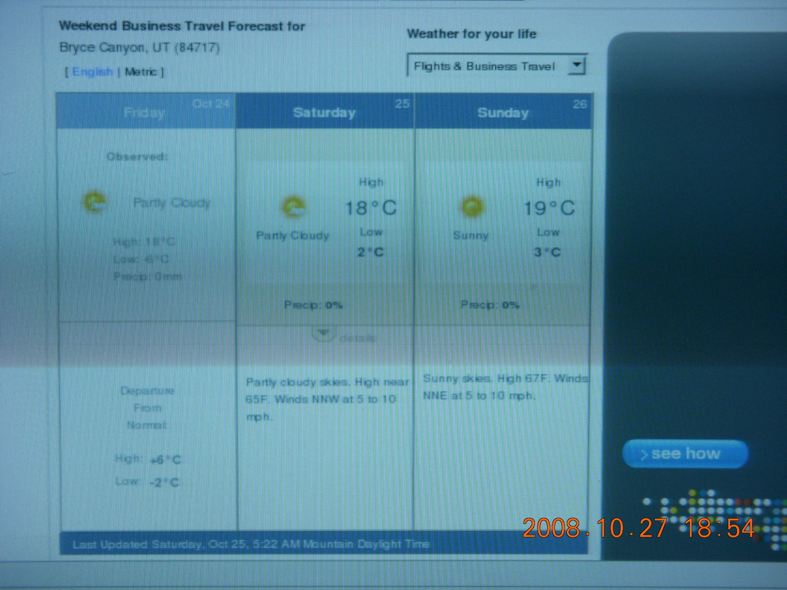
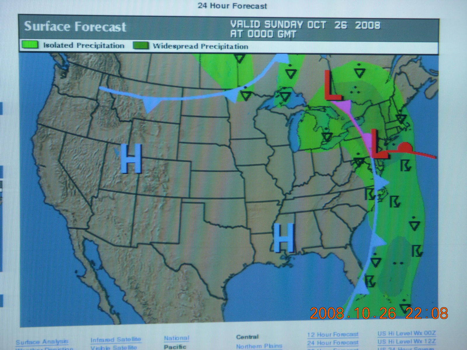
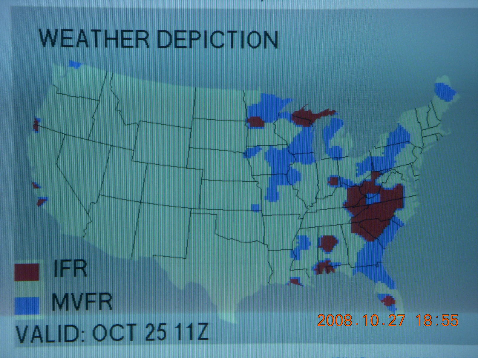
A week before my trip
the weather for this weekend was forecast to be gorgeous and sunny
Friday through Monday throughout the area,
the forecast stayed good up until my departure,
and the weather was as good as predicted.
Hotel and rental car were easily available in late October.
I arranged for
Animal Planners
to take good care
of my two cats in my 35-hour absence.
I have a terrific mechanic who works on my airplane.
In four years I have missed only one weekend
due to an unscheduled problem not taken care of by Friday afternoon.
Cooler weather means easier flying,
particularly taking off from Bryce Canyon Airport
(BCE,
elevation 7600 feet, 2300 meters, 775 millibars).
A week before my trip
the weather for this weekend was forecast to be gorgeous and sunny
Friday through Monday throughout the area,
the forecast stayed good up until my departure,
and the weather was as good as predicted.
 I would remind the traveler that Utah is a
Daylight-Savings-Time state.
That means they reset their clocks twice a year
(mnemonic: "spring forward and fall back")
so their summer evenings have more daylight.
The effect on us morning people is to have
less daylight in the summer.
The effect on anybody is that you have to check your calendar
to find out what time it is when you visit there.
Fortunately for me,
Arizona does not participate in this time-change program.
I would remind the traveler that Utah is a
Daylight-Savings-Time state.
That means they reset their clocks twice a year
(mnemonic: "spring forward and fall back")
so their summer evenings have more daylight.
The effect on us morning people is to have
less daylight in the summer.
The effect on anybody is that you have to check your calendar
to find out what time it is when you visit there.
Fortunately for me,
Arizona does not participate in this time-change program.
The last element on my pre-trip checklist is my own health. I'm running pretty well, good endurance for hiking high-altitude hills, no sore knees or aching back, not even the sniffles, and I'm well rested with plenty of sleep. I'm ready to enjoy my weekend at Bryce Canyon.
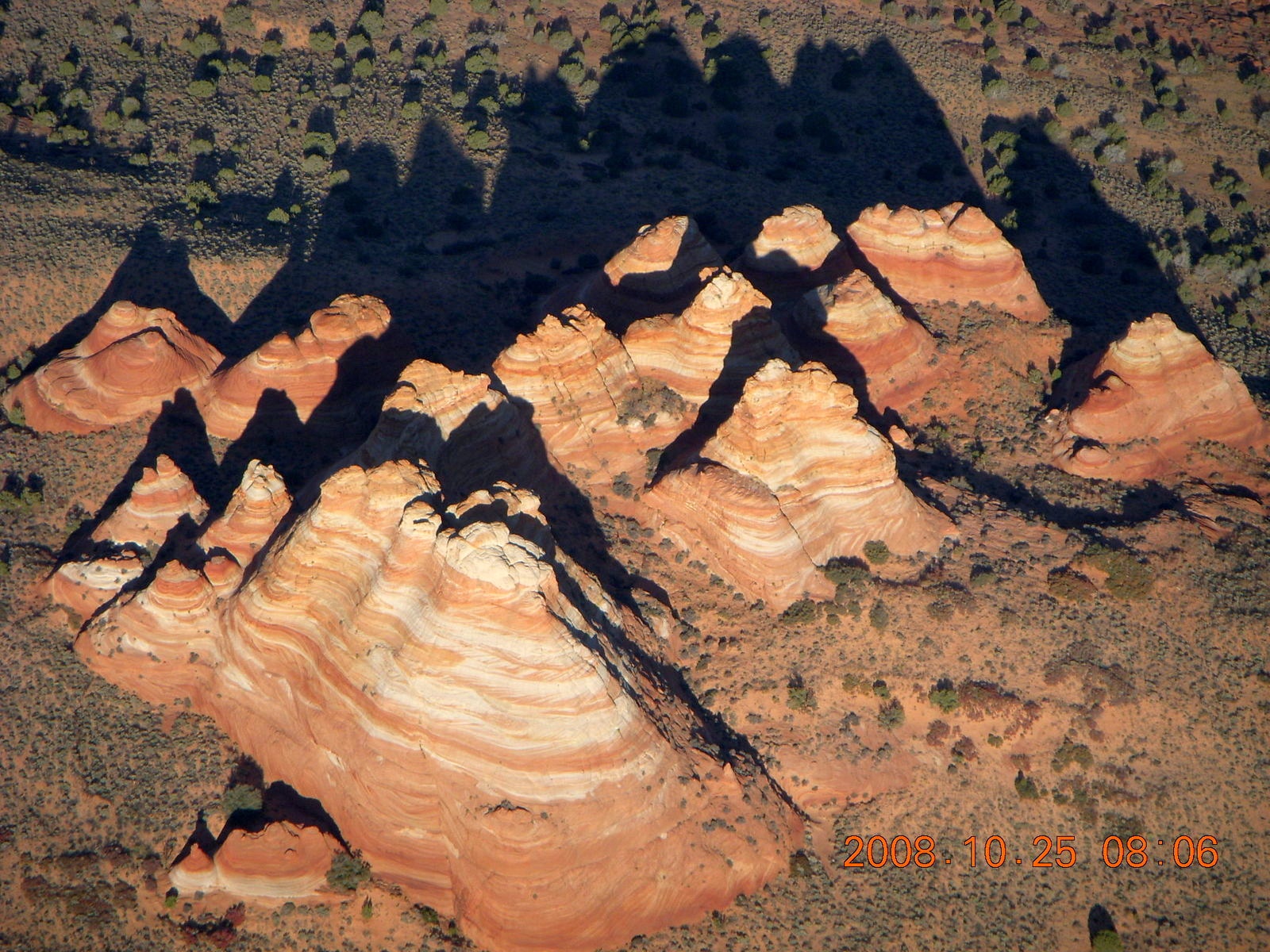
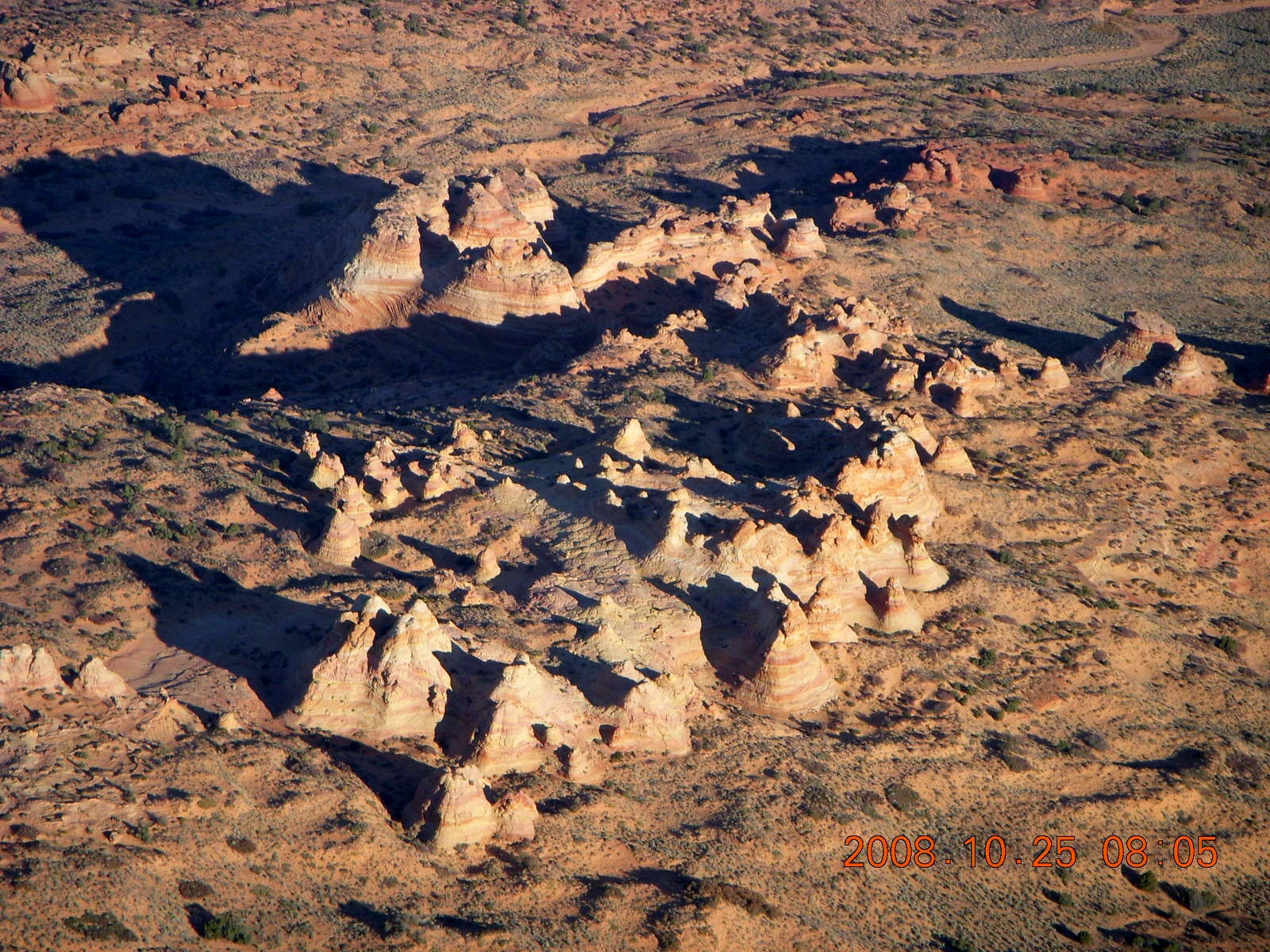
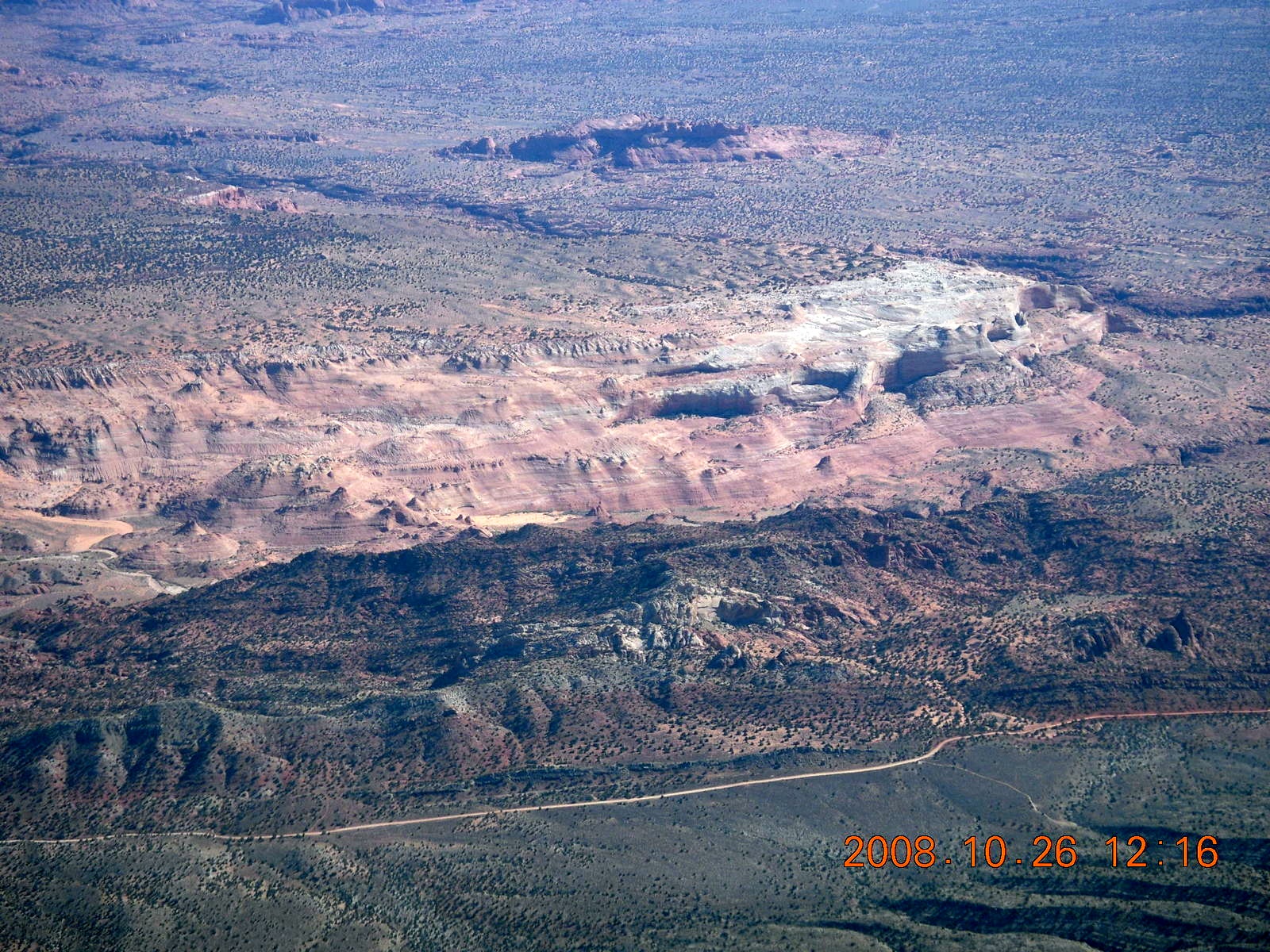
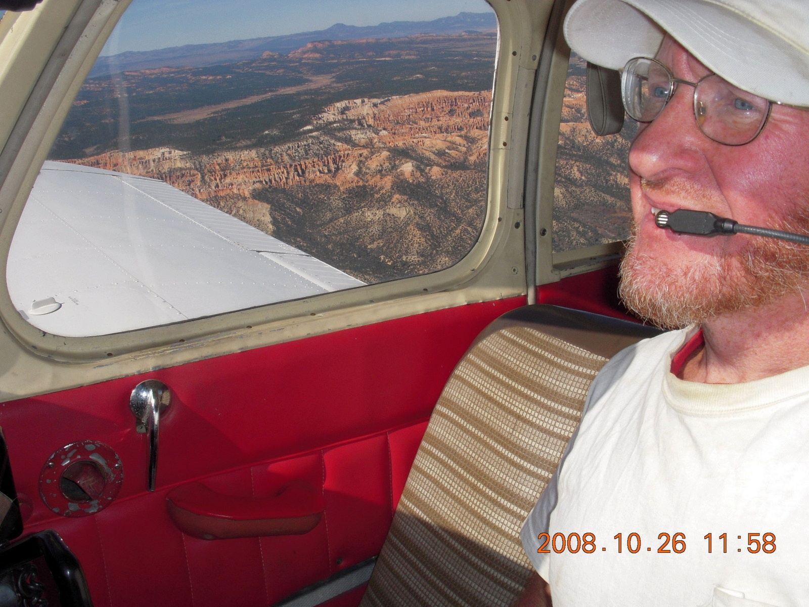
I decided to make a small detour,
ten or fifteen minutes with circling to take pictures,
to see The Wave,
a geologic formation seen in pictures
that looks really cool to hike.
They only allow twenty hikers in there each day
and I wanted to see what it looks like from the air.
The surrounding area has steep, cone-shaped mountains
that are neat to look at
and the The Wave itself is a small area of wavy rock, no surprise.
The park itself is wonderful with its strange shapes
and intriguing colors.
The person-shaped hoodoos are quite visible from the air
as I fly by.
Bryce Canyon is small by national-park standards,
30 kilometers (18 miles) north-south and
six kilometers (four miles) east-west.
While the Grand Canyon provides a landscape from the air,
Bryce Canyon is something beautiful to look at.
It's too small to surround an airplane,
even a small airplane only 2500 feet (800 meters) above it.
Returning to Deer Valley
(DVT)
I was met by Brian at Cutter Aviation
where I tie down my airplane and buy my fuel.
He helped me with chains and my airplane cover,
a whole lot easier with two people than one,
and gave me a lift back to the office where
both Connie and Julie were there to greet me
and to take my top-off fuel order for next weekend.
It was nice to be treated like the jet-set people
who fly noisy, expensive, turbine-powered airplanes,
the people who spend big bucks for fuel and service.
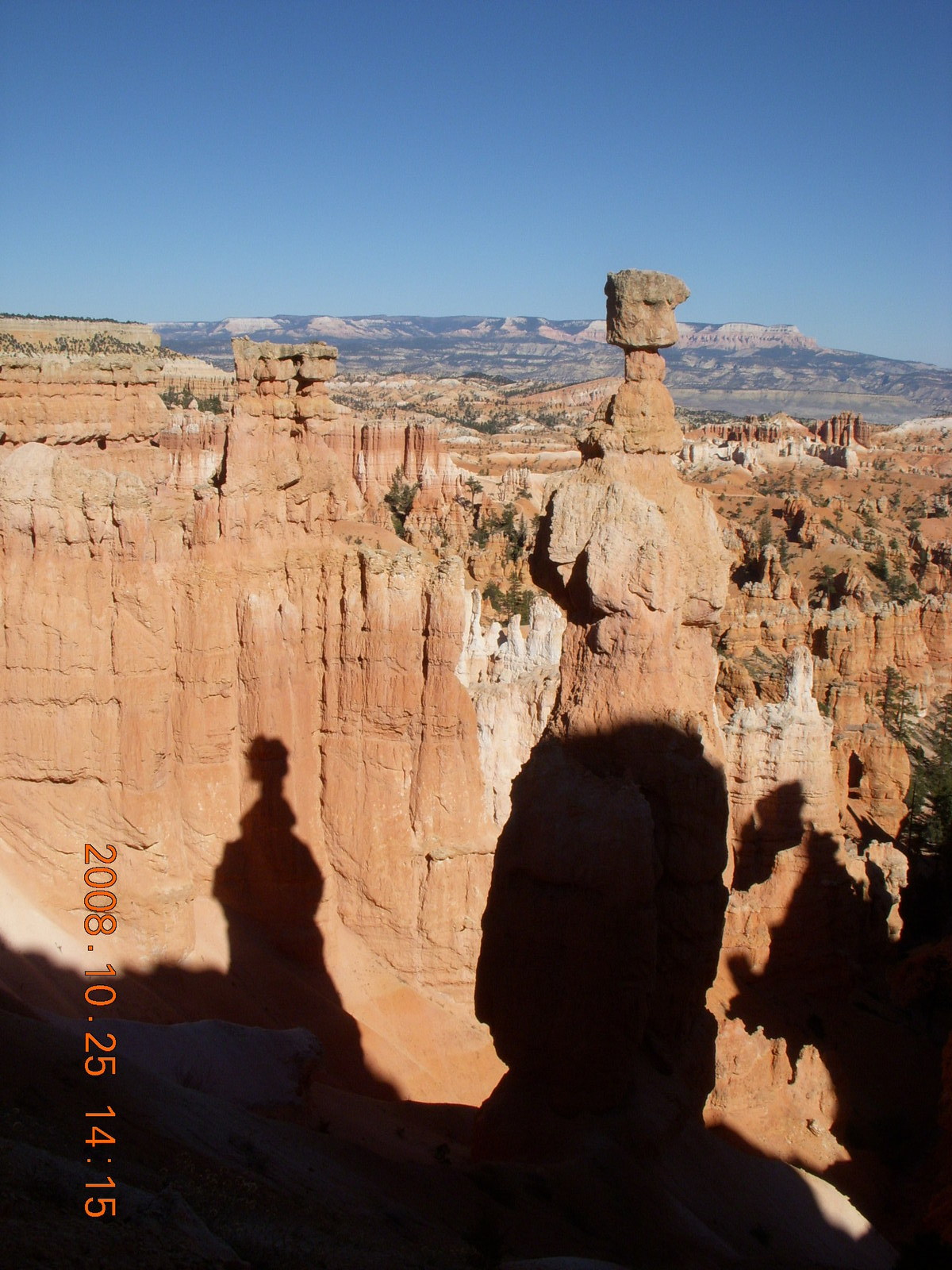
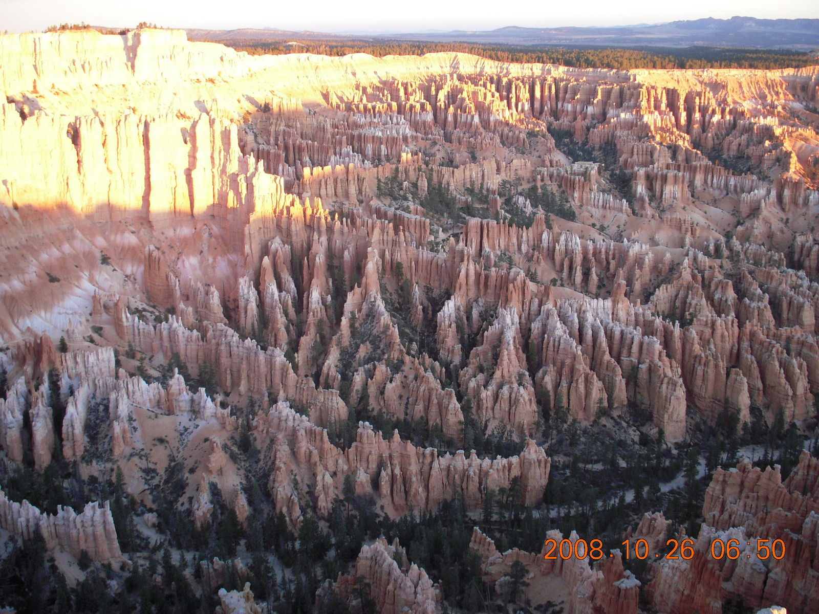
If the Grand Canyon is about looking down,
if Zion is about looking up,
if Canyonlands is about looking out,
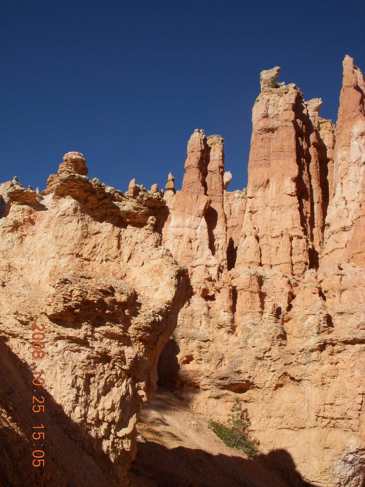
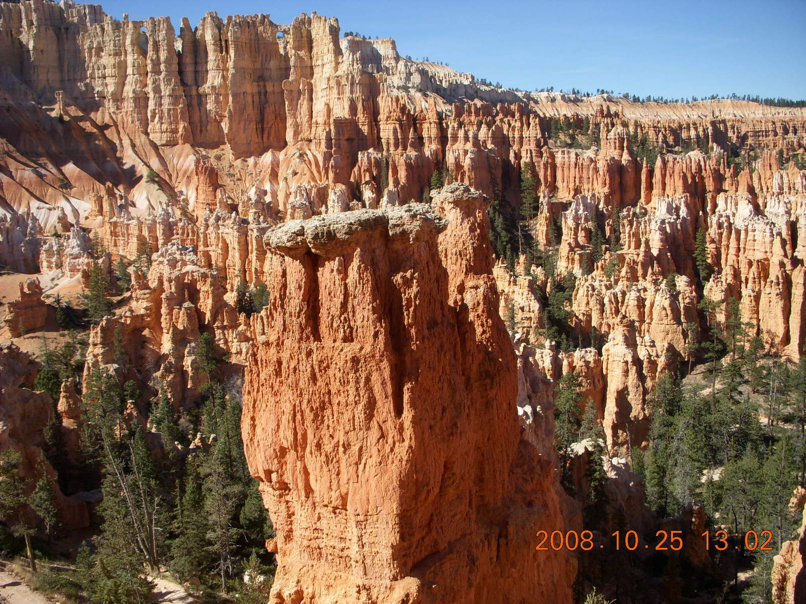
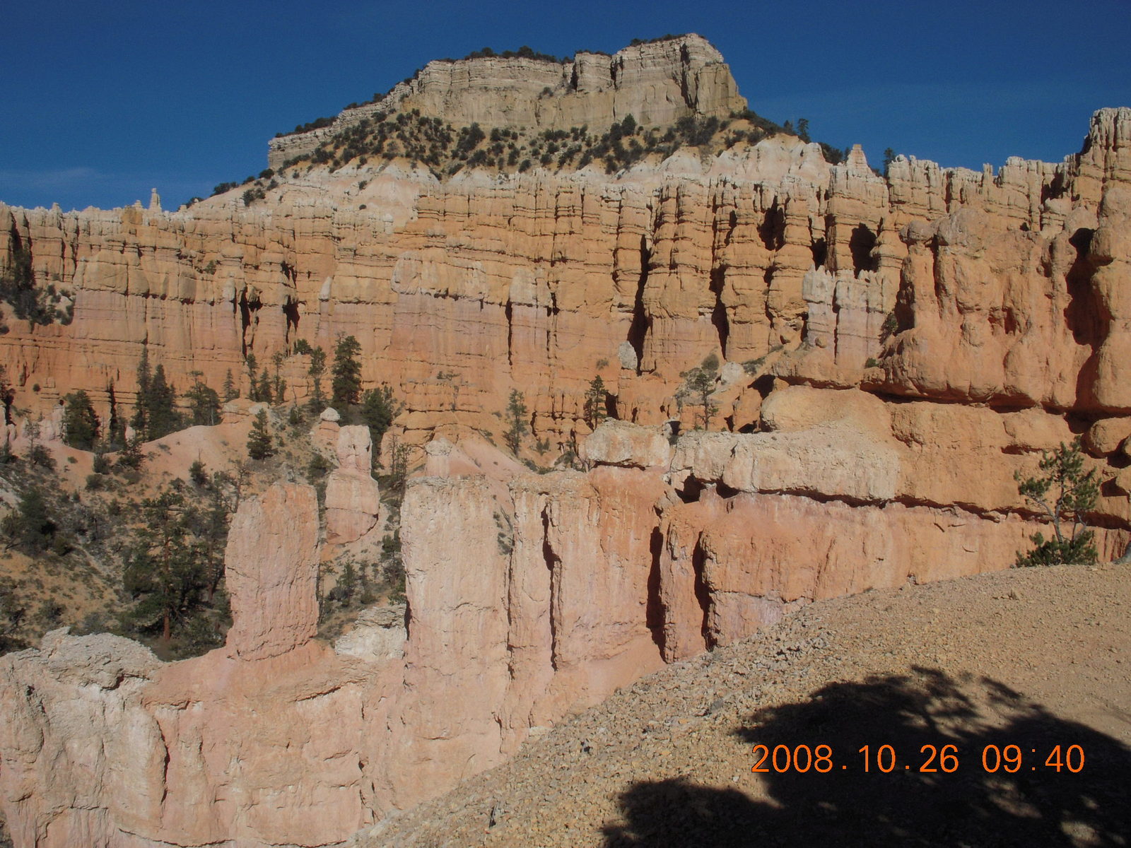
then the beauty of Bryce Canyon is intimate, right in your face.
Some rock shapes are within arms reach, close enough to touch,
while others are vista views.
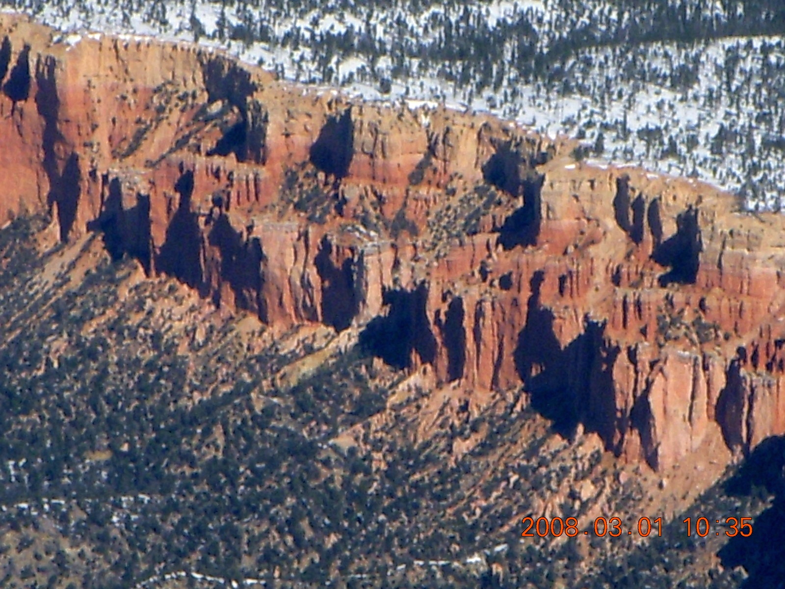
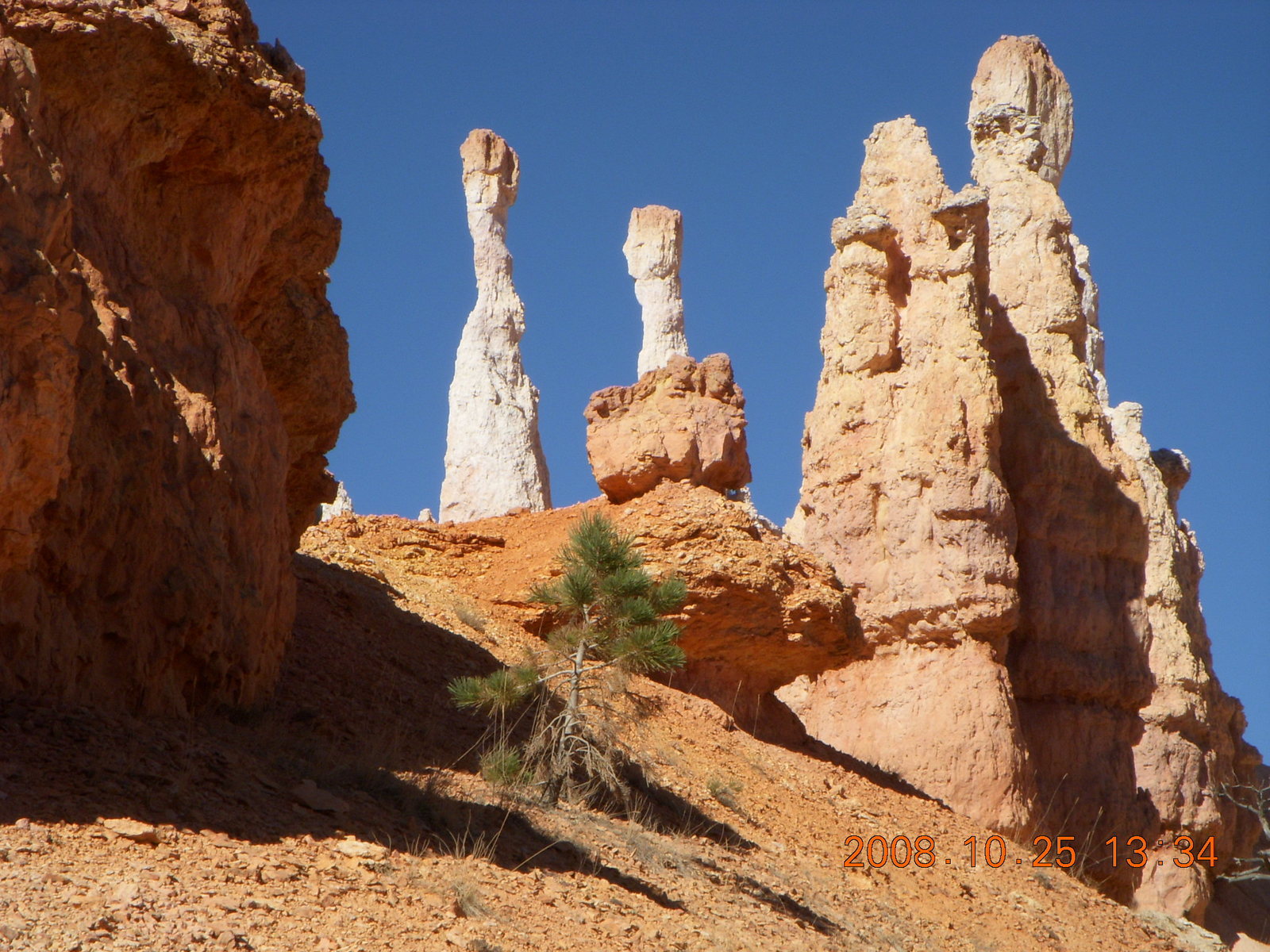
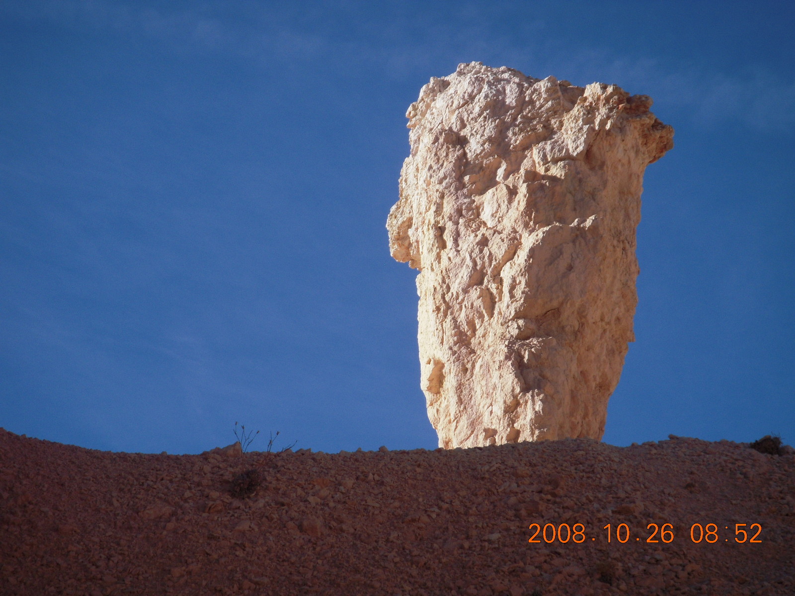
Color is a recurrent theme in the Bryce Canyon experience with
sulfur yellow,
iron red,
magnesium purple,
limestone or quartz white,
and some copper green
layered and woven in the rocks.
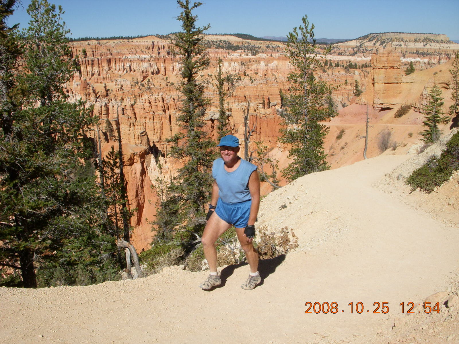
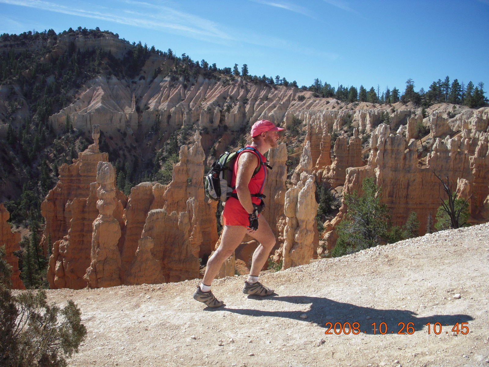
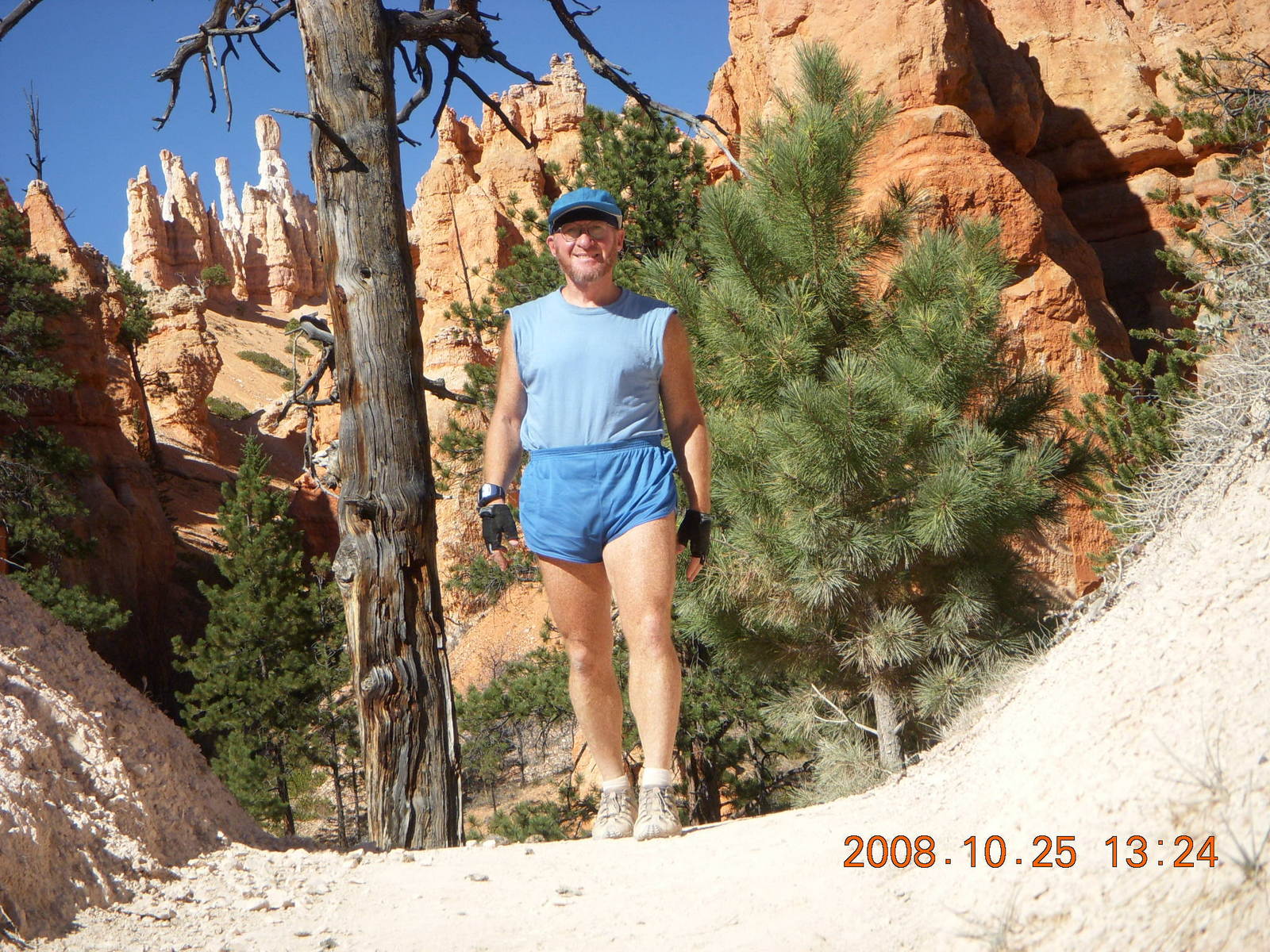
This hiker is also getting a workout.
The trails go from 8300 feet (2530 meters, 755 millibars)
down to 7100 feet (2165 meters, 790 millibars)
with plenty of hills down and up.
I'm a runner who can run ten miles
and a hiker who has can hike ten hilly miles
and I found my pulse
quickened
as I hiked up the hills back to trailheads.
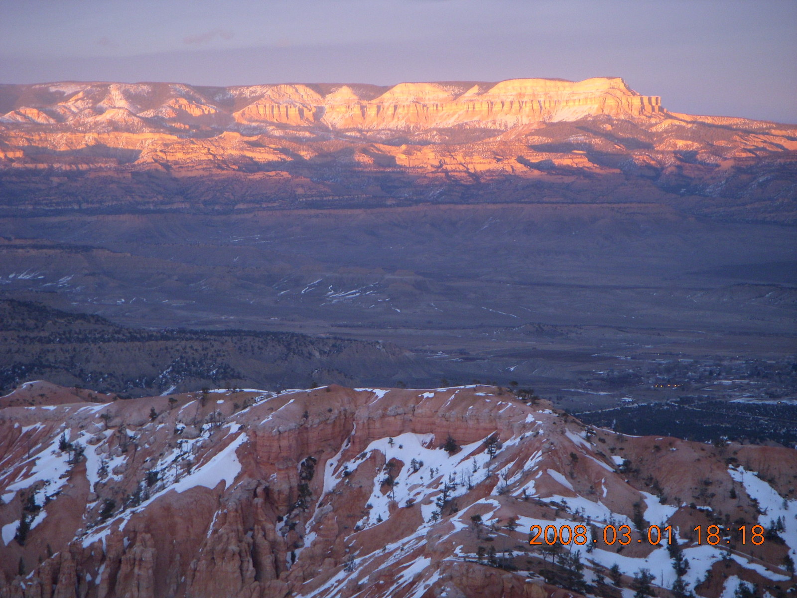
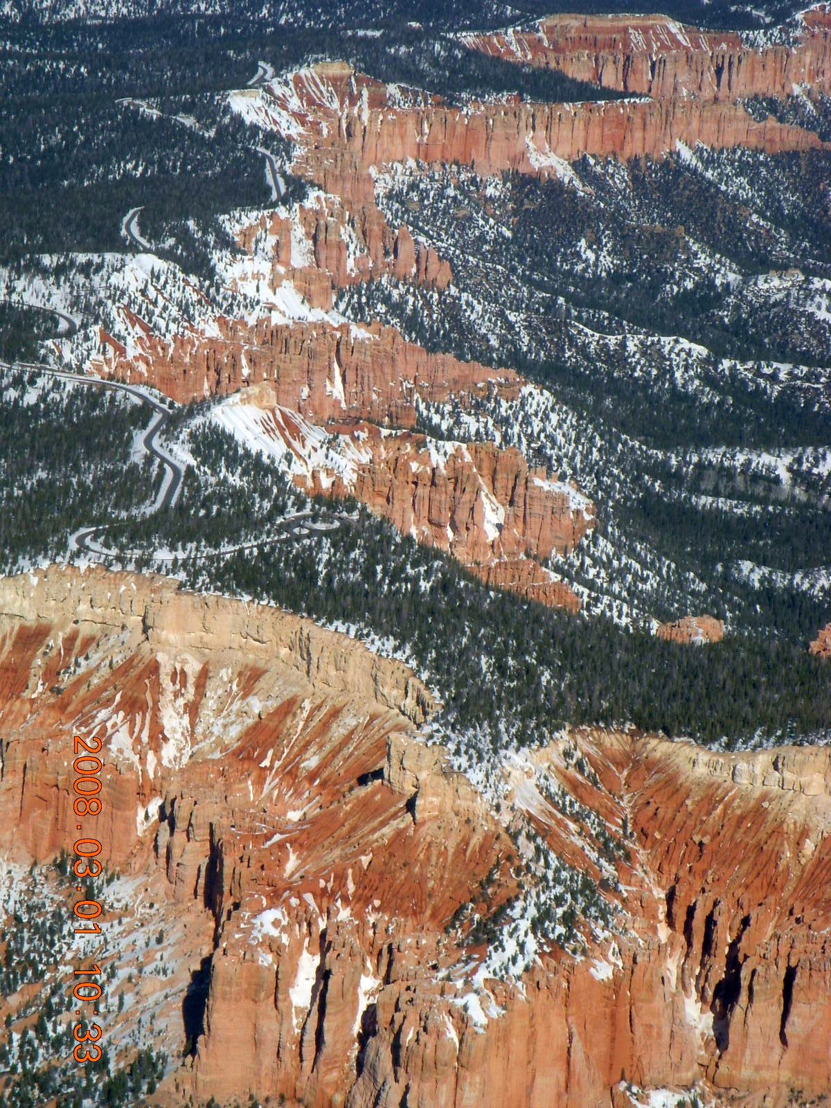
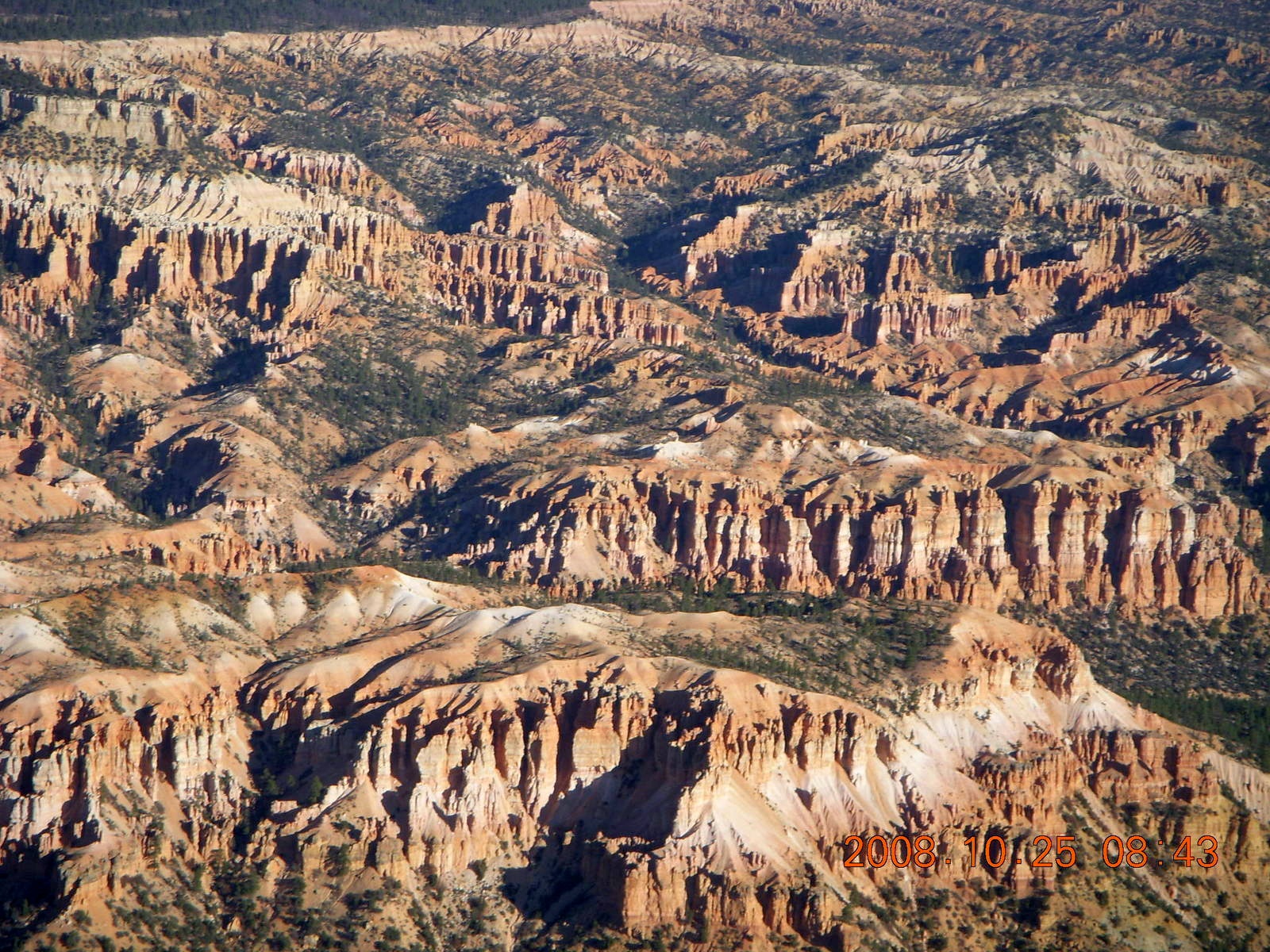
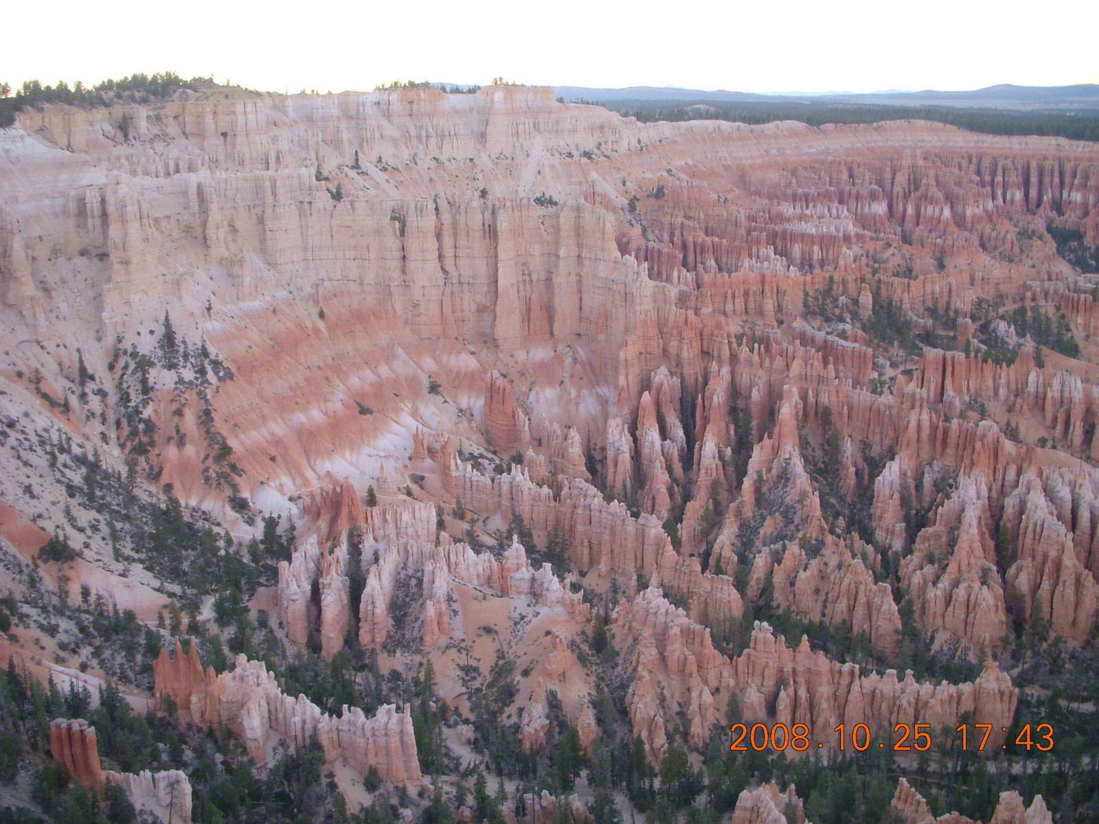
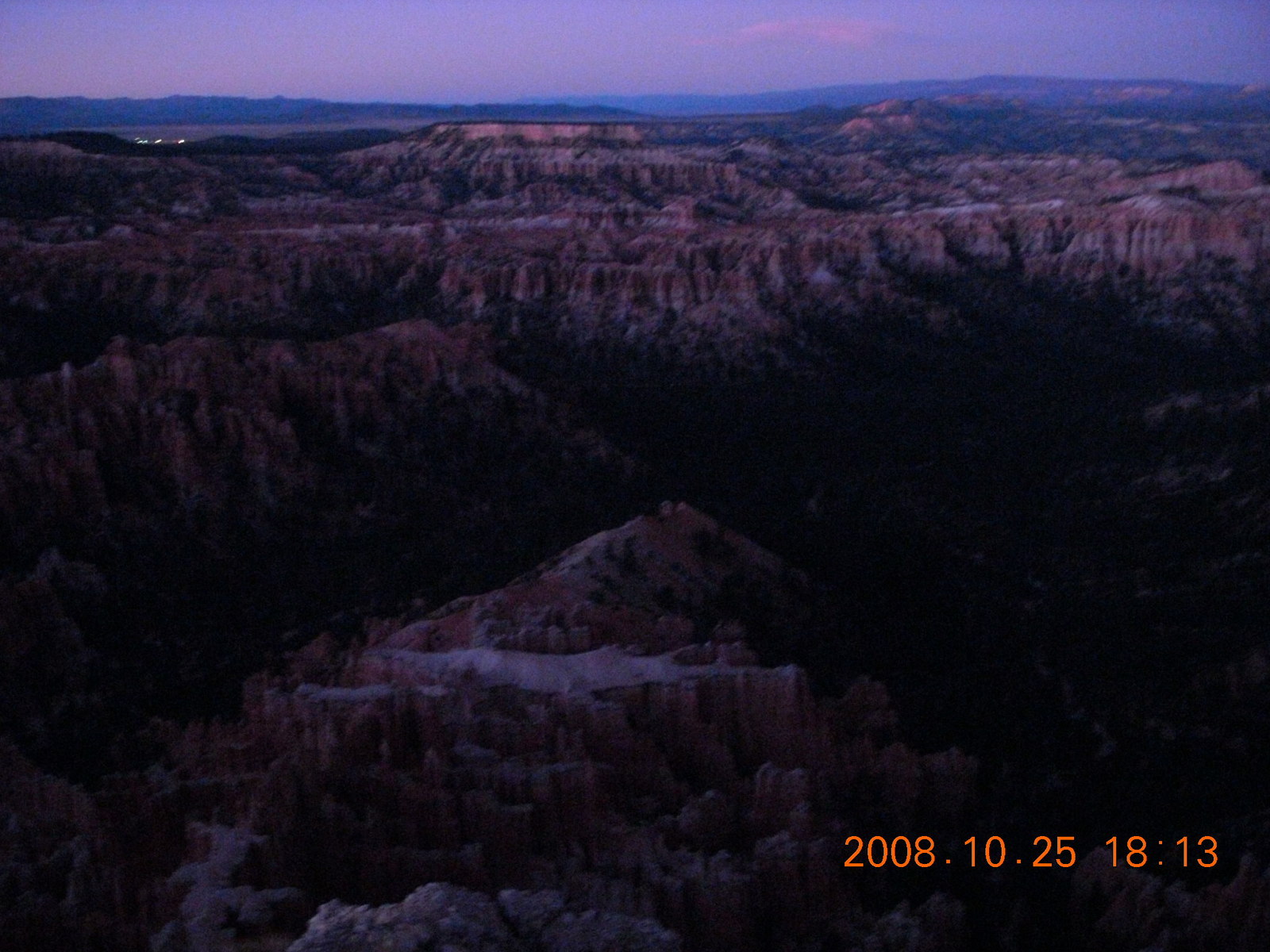
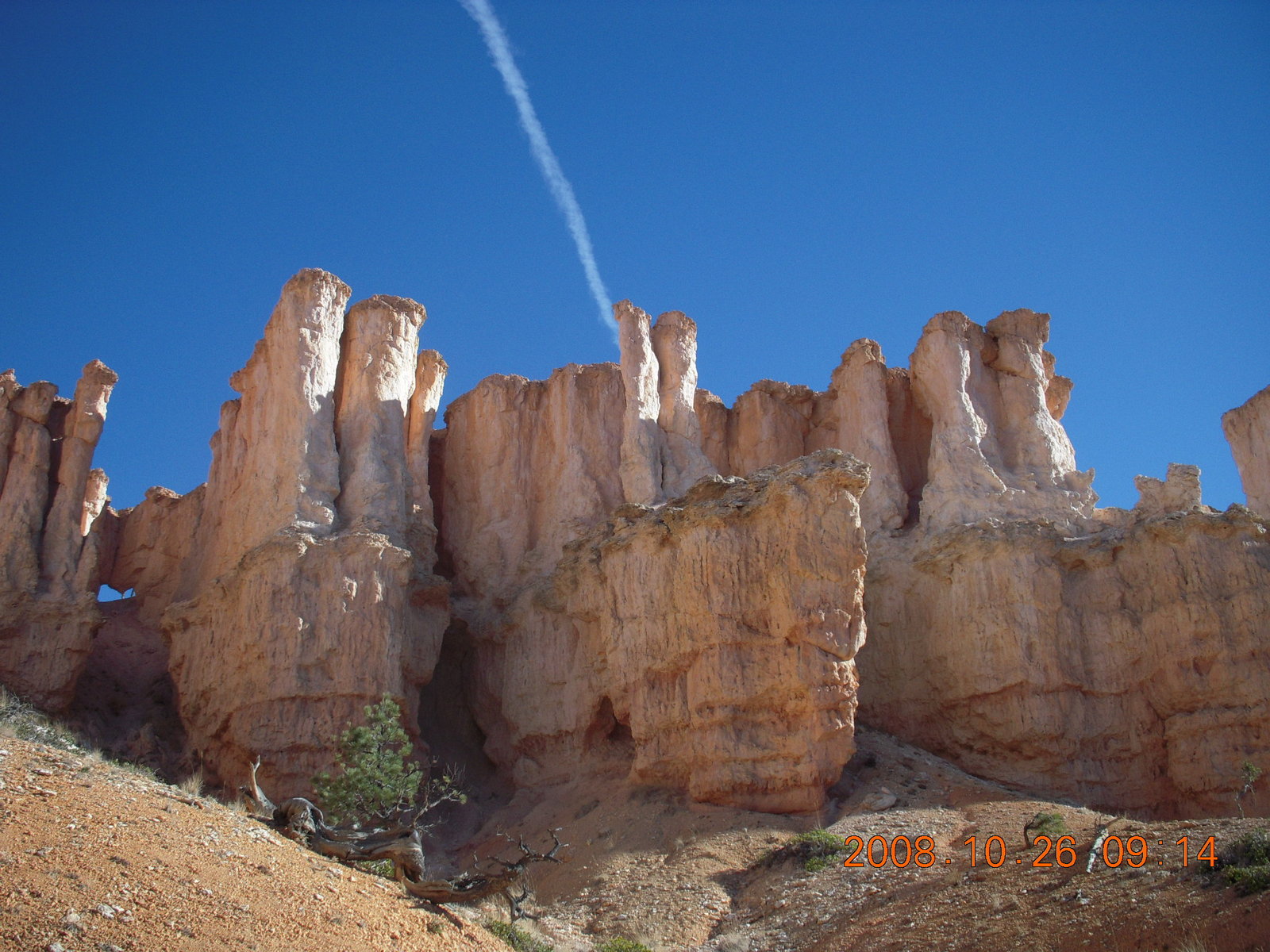
Let me have a few words about the amphitheater at Bryce Canyon.
It's not really a theater, amphi- or otherwise.
While the entire park is strewn with hoodoos,
they're concentrated in an almost-circular region
in the middle,
maybe 3000 meters (two miles) across.
This arena of frozen souls is shaped like an amphitheater
so they call it the amphitheater.
It can be seen from above at several vista viewpoints
with vista-view names like
Sunrise Point,
Sunset Point,
Inspiration Point,
and finally
Bryce Point.
It can be seen from inside on the trails I hiked on Saturday.
The 4-Km (2.5-mile) rim trail
is flat and smooth enough to run most of it
with my water-pack bouncing gently on my back,
especially the downhill parts,
especially the part behind hills with no view of the hoodoos.
It's a nice way to warm up in the coldest part of the day.
I started with spandex on my legs and two long-sleeve t-shirts
and finished with one of those t-shirts packed
in my CamelBak pack.
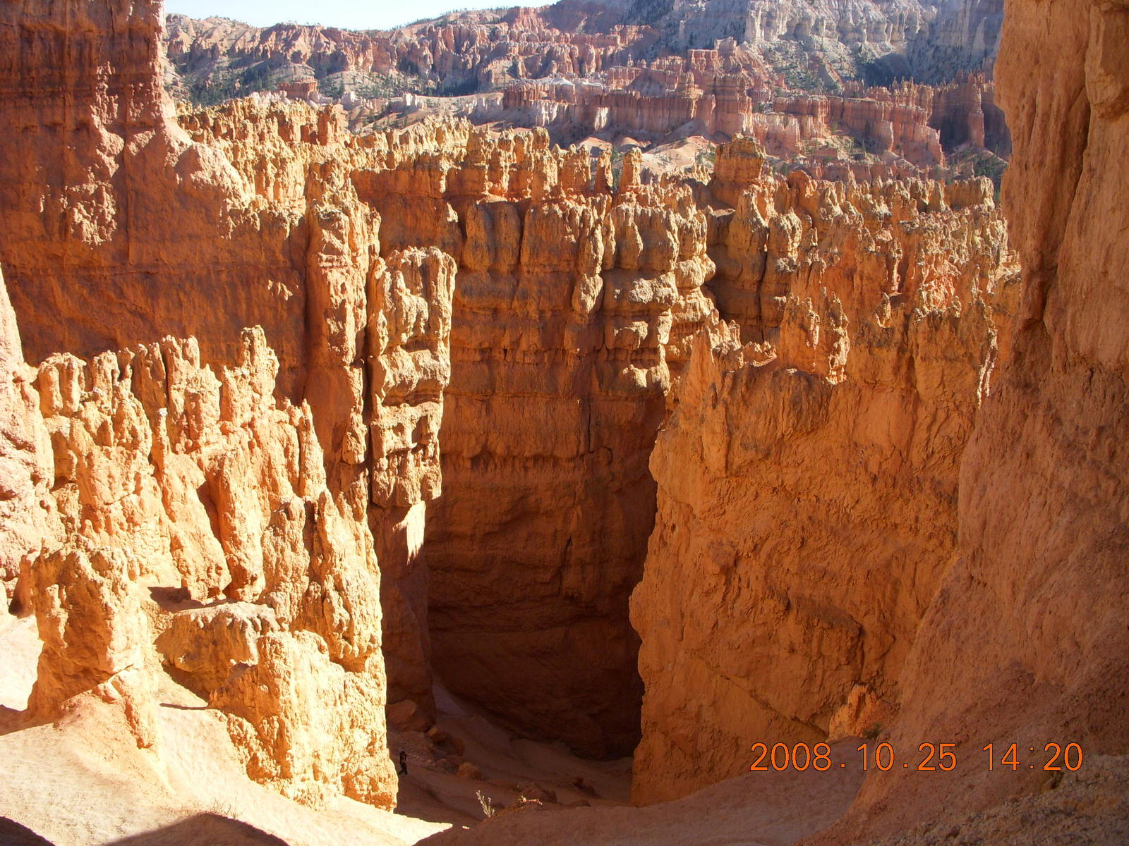
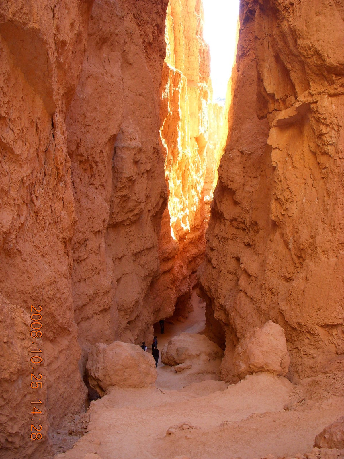
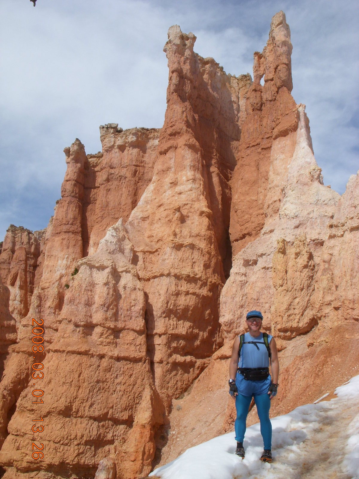
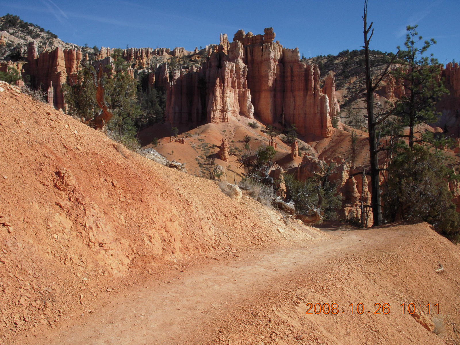
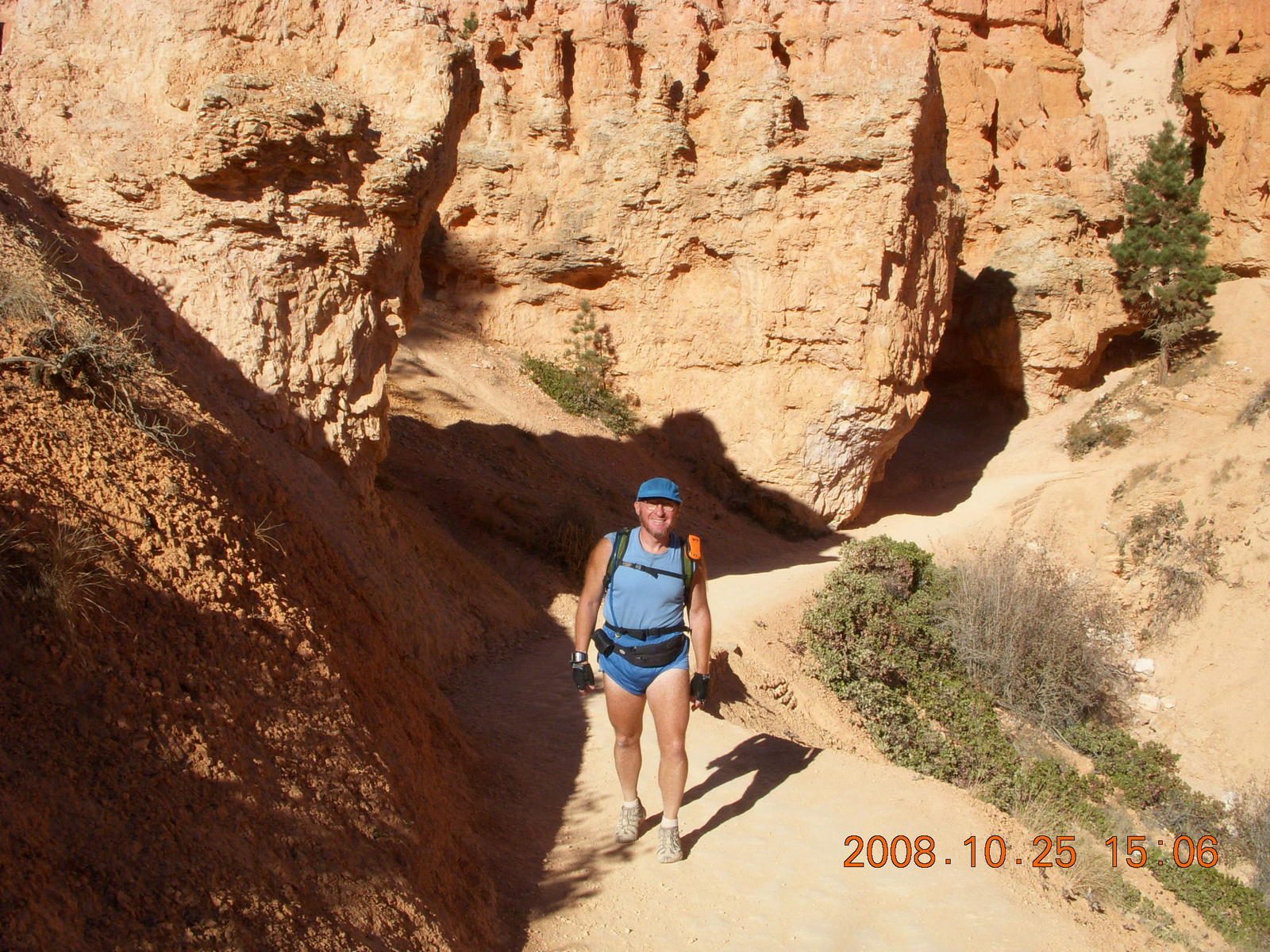
The 3-Km (two-mile) Tower Bridge trail
descends through beautiful formations of hoodoos,
tall rock shapes, views of the east valley,
and undulating terrain.
The spandex leg warmers were stuffed into the pack
on the uphill after I passed Tower Bridge.
By the time I'm back to Fairyland viewpoint,
my legs are just tired and my feet are just sore enough
that I'm ready for my trip home.
I'll leave this place with the confidence
that I'll be here again.
My hiking pack has all kinds of in-case-I-need-it goodies
some of which seem far fetched, but I've needed things
like energy bars, sunscreen, petroleum jelly,
three liters of water,
three extra layers of clothing,
and now I carry my
SPOT in case of trouble.
I still haven't needed the crampons on summer hikes,
but I didn't think I would need the headlamp in broad daylight
until I found some small caves in Snow Canyon last spring.
I ran into a hiker who had a serious headache,
he needed ibuprofin pain pills,
and I didn't have any.
So one more item has been added
to the in-case-I-need-it goodies list.
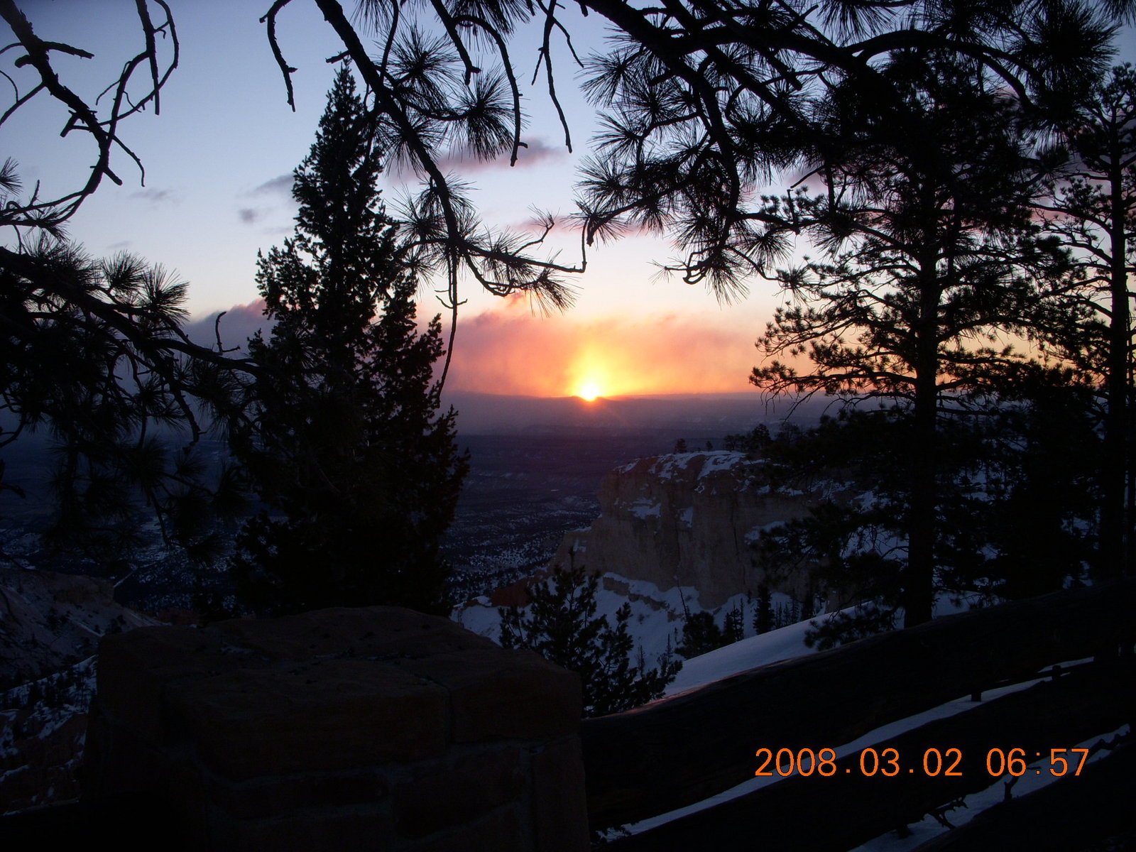
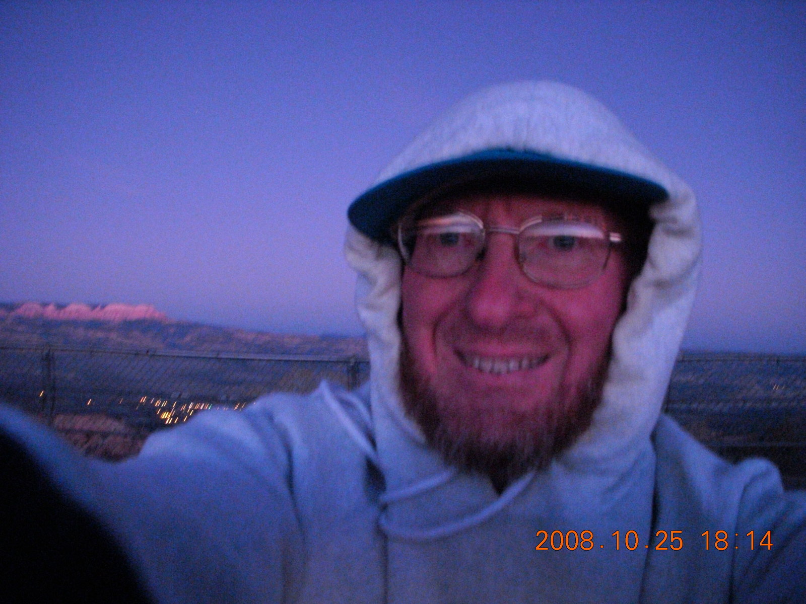
If there was one fly in the ointment of the weekend,
then it was my timing of the sunset view.
My GPS said sunset was 5:39 (Arizona time)
and I got to Bryce Point at 5:30
to find the sun had already gone over the mountains.
The remaining fading light was wonderful
as the red hoodoos laced with white
fade into white shapes with the red too dark to see.
The orange horizon finally faded away into darkness.
I used the last fading twilight
to come back to the parking lot from the viewpoint
and joined a bunch of guys lying on their backs
to see the sky.
It didn't really matter how goofy we all looked
because it was too dark to see us anyway.

Flying
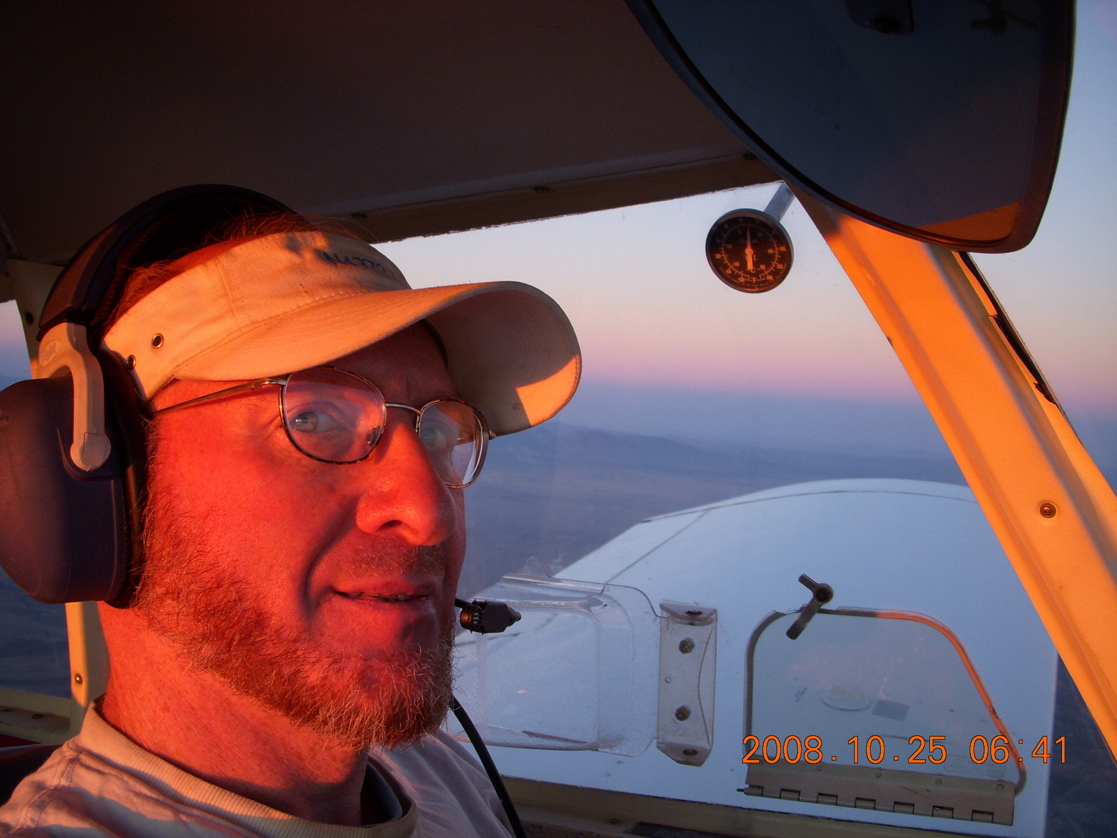 My airplane is ready to fly, all systems go.
It has been flying well all summer
and the cooler weather makes things a lot easier.
In aviation we call the total effect
of altitude, temperature, local air pressure, and humidity
density altitude.
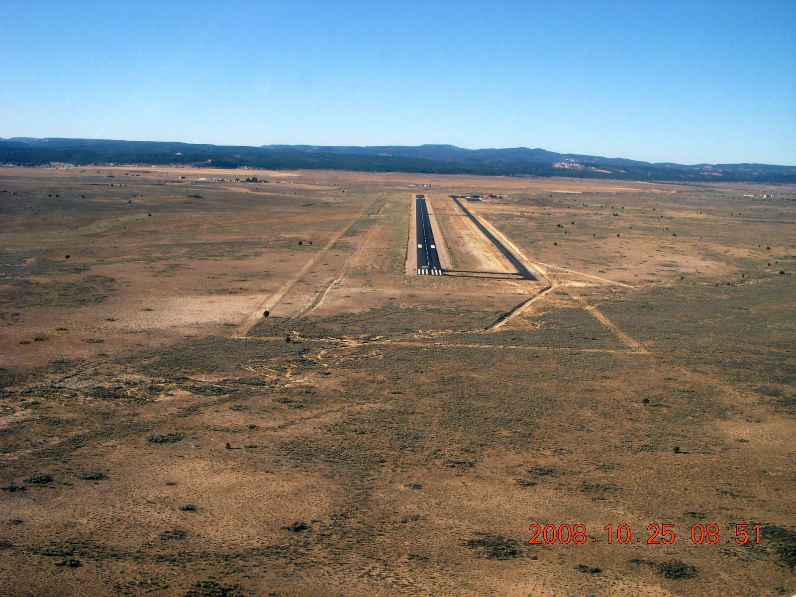
Bryce Canyon Airport
(BCE)
is 7560 feet above sea level.
At summer 35° C (95° F) there isn't enough air
for my airplane to depart.
The density altitude is 11700 feet, 3570 meters,
too thin for take-off in my airplane.
At autumn 15° C (60° F) there's plenty of runway
and the open field north of the airport gives me room to climb.
The density altitude is 9300 feet, 2840 meters,
which gives me enough room to depart BCE with a margin of safety.
My airplane is ready to fly, all systems go.
It has been flying well all summer
and the cooler weather makes things a lot easier.
In aviation we call the total effect
of altitude, temperature, local air pressure, and humidity
density altitude.
Bryce Canyon Airport
(BCE)
is 7560 feet above sea level.
At summer 35° C (95° F) there isn't enough air
for my airplane to depart.
The density altitude is 11700 feet, 3570 meters,
too thin for take-off in my airplane.
At autumn 15° C (60° F) there's plenty of runway
and the open field north of the airport gives me room to climb.
The density altitude is 9300 feet, 2840 meters,
which gives me enough room to depart BCE with a margin of safety.
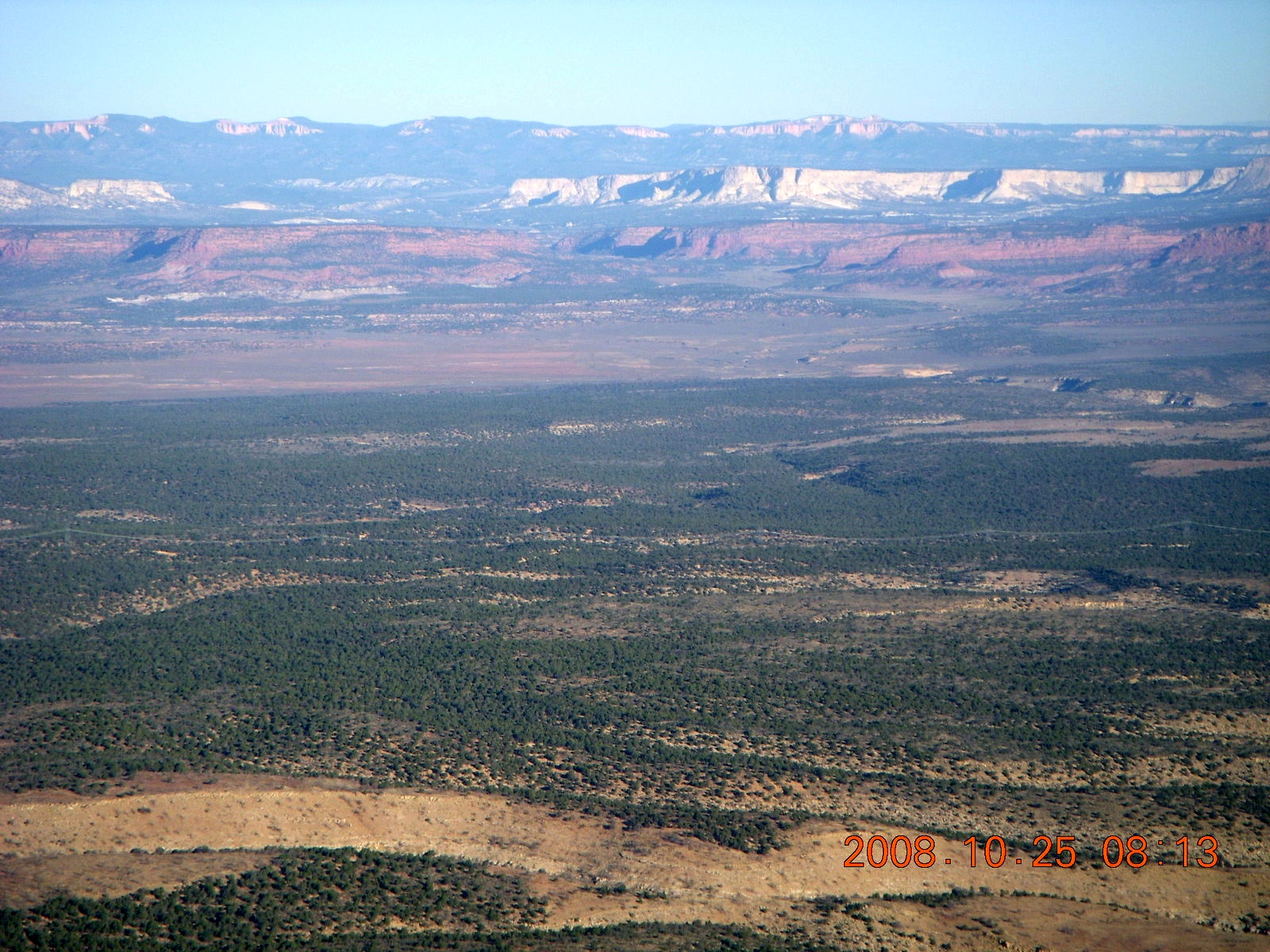
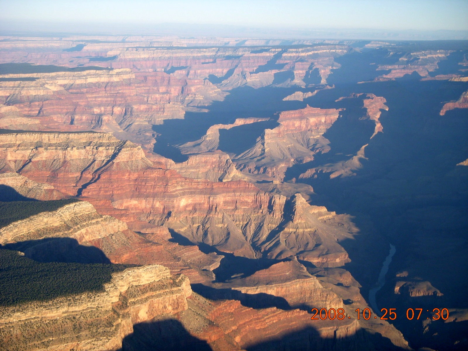
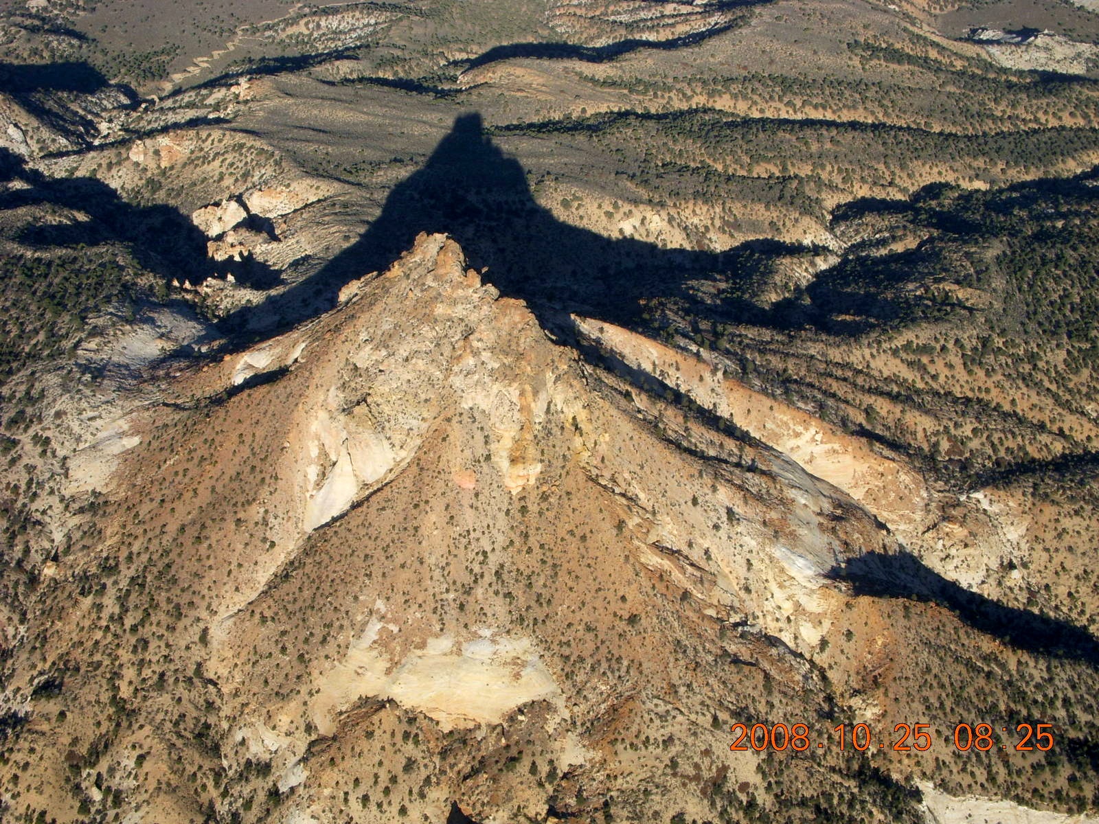
 The route of flight is straightforward,
a straight north-south line
following the Dragon Corridor over the Grand Canyon,
past the orange and white cliffs in Utah
that look like lunar landscapes,
and along the east side of the park
with the hoodoos and amphitheater.
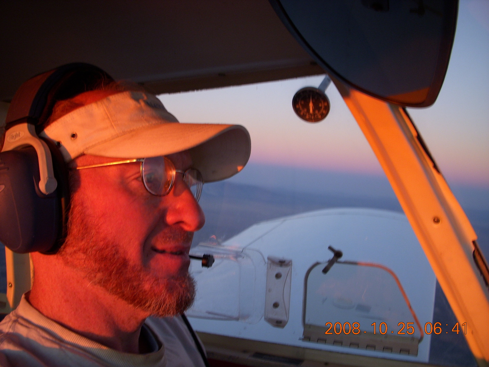
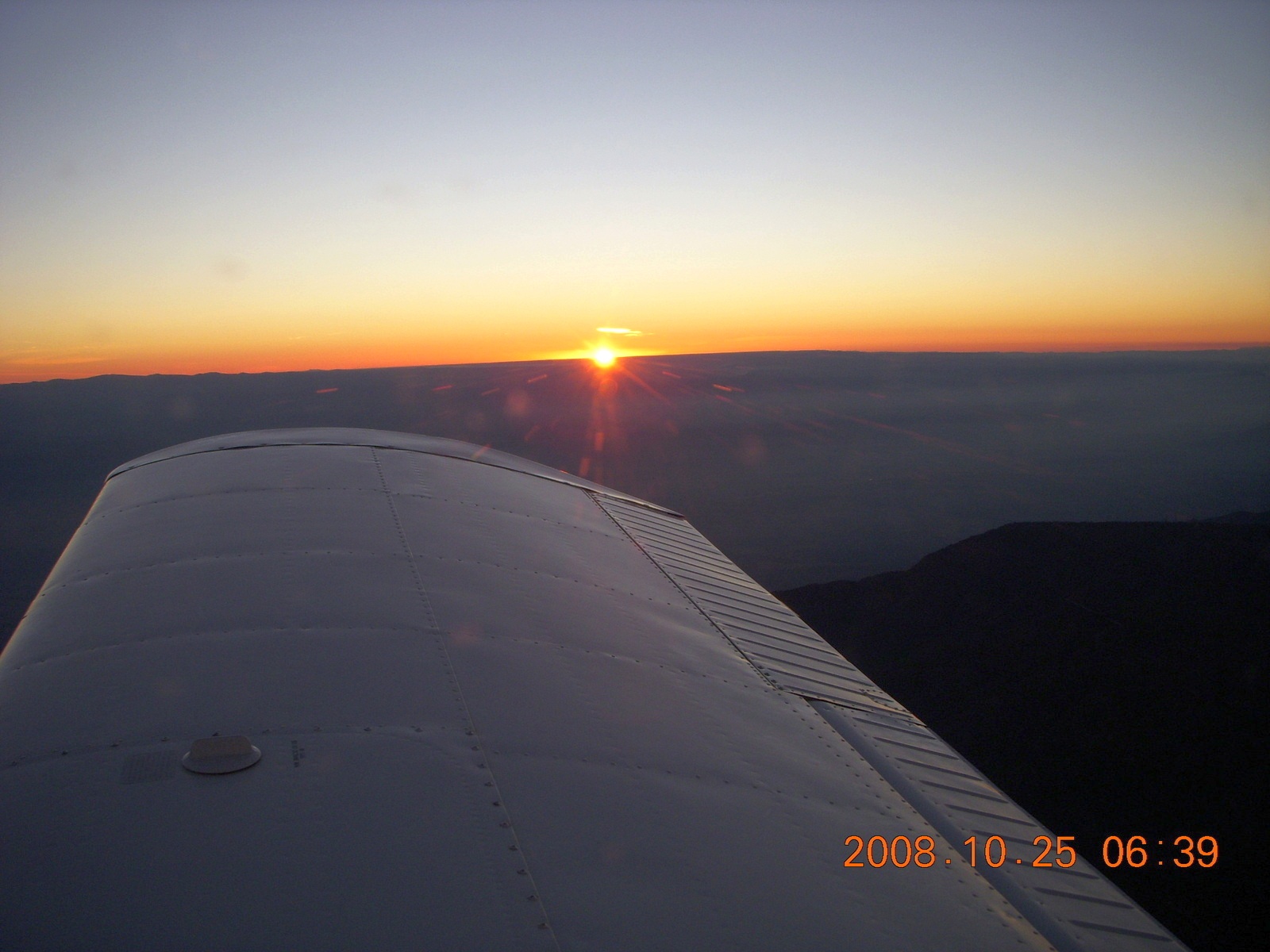
I took off just before 6:00,
sunrise came around 6:45,
and I crossed the Grand Canyon forty-five minutes later at 7:30.
One time I arranged to fly over the Canyon right at dawn
only to find the
entire
area below the rim was still in shadow.
Now I know to fly almost an hour later
for cool-looking, long shadows on the rock formations
inside the canyon.
The route of flight is straightforward,
a straight north-south line
following the Dragon Corridor over the Grand Canyon,
past the orange and white cliffs in Utah
that look like lunar landscapes,
and along the east side of the park
with the hoodoos and amphitheater.
I took off just before 6:00,
sunrise came around 6:45,
and I crossed the Grand Canyon forty-five minutes later at 7:30.
One time I arranged to fly over the Canyon right at dawn
only to find the
entire
area below the rim was still in shadow.
Now I know to fly almost an hour later
for cool-looking, long shadows on the rock formations
inside the canyon.
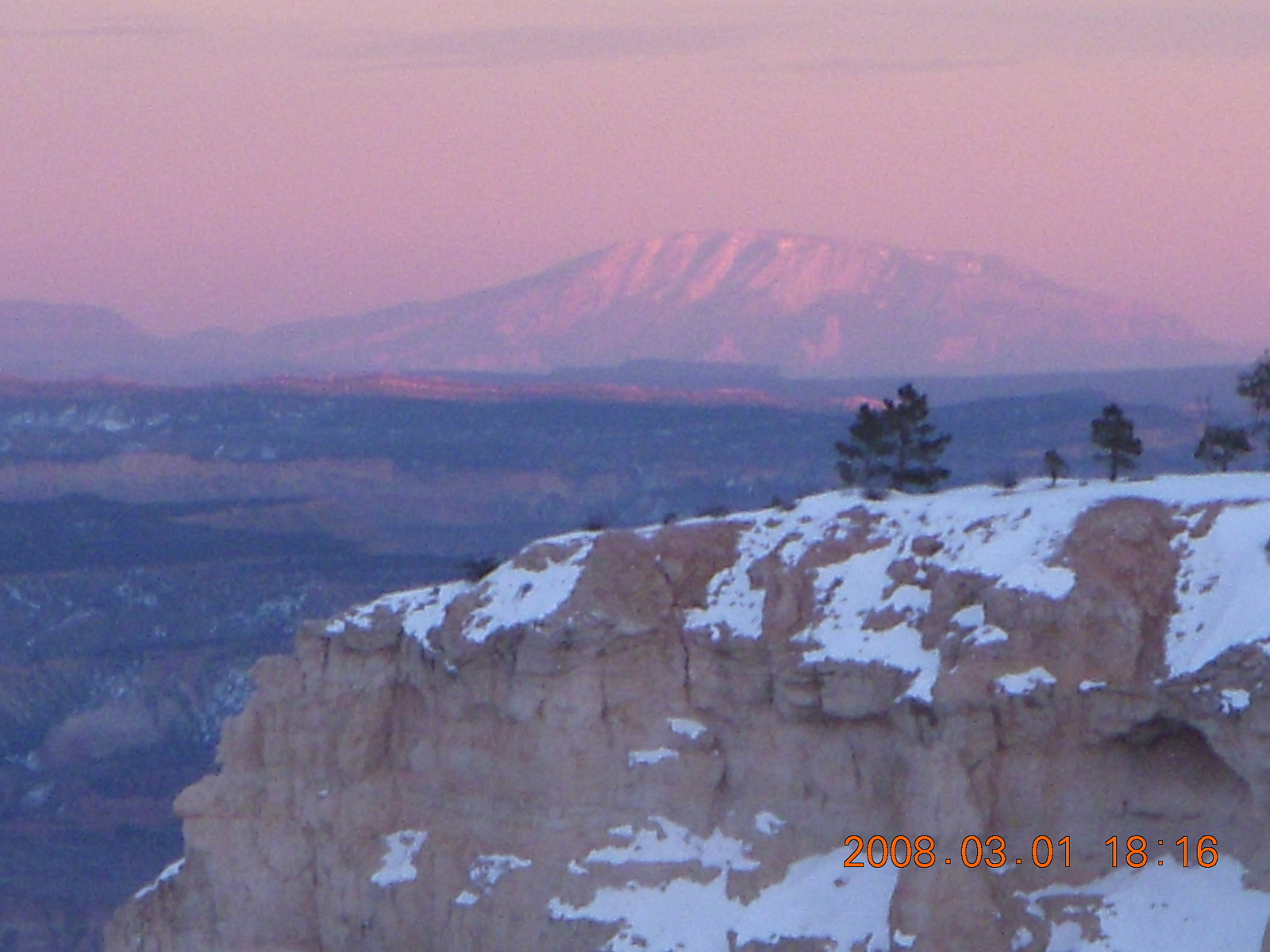
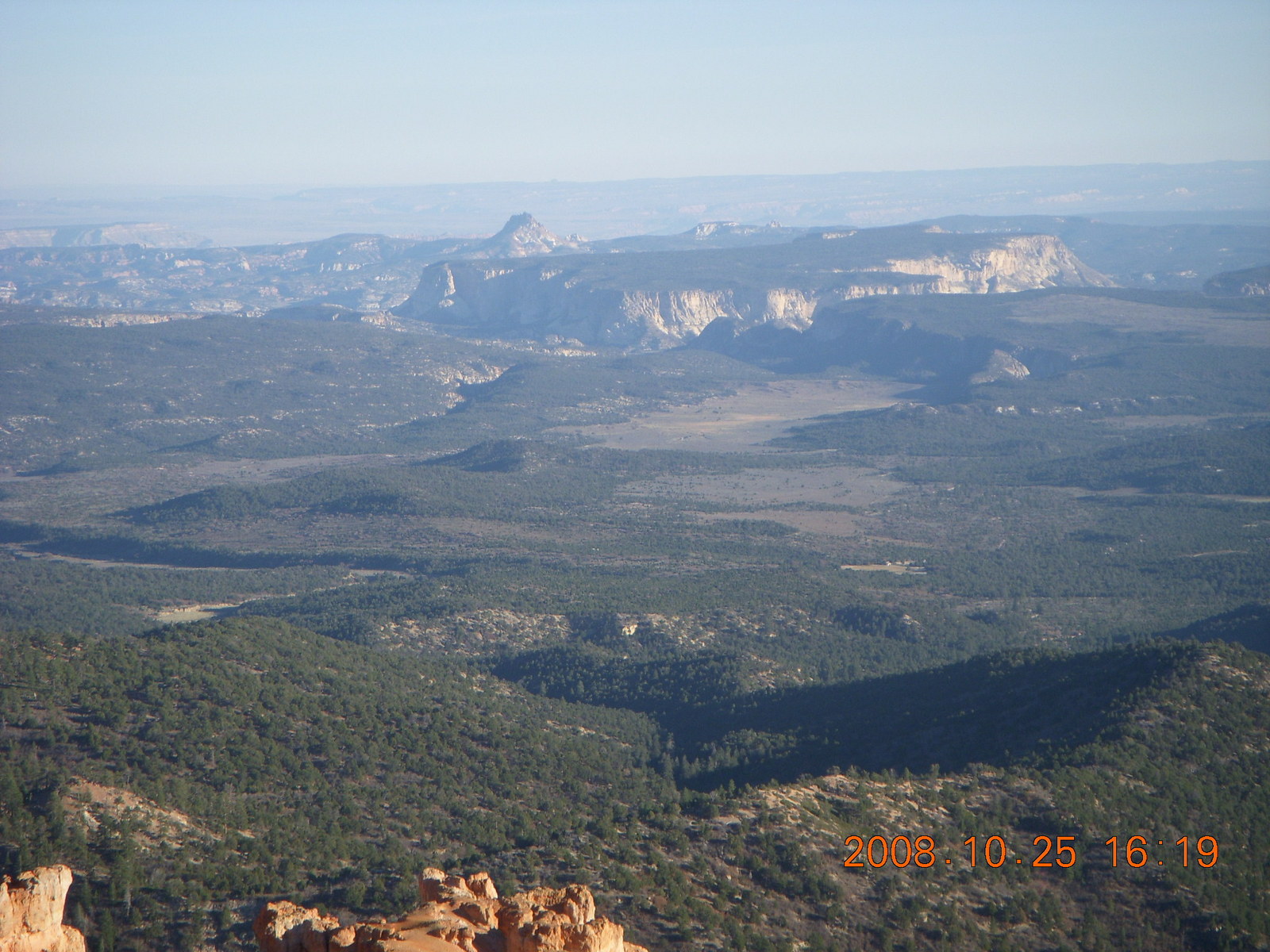 Before I learned to fly,
I would gaze out from Bryce Canyon's south end,
Yovimpa Point,
and see the bizarre formations of Utah's lunar-looking landscape,
something from a science fiction book
or one of the "Yes" record covers.
Two of those formations are
Molly's Nipple and No Man's Mesa.
They're less mysterious from the air,
but still fun to look at from above and nearby.
Before I learned to fly,
I would gaze out from Bryce Canyon's south end,
Yovimpa Point,
and see the bizarre formations of Utah's lunar-looking landscape,
something from a science fiction book
or one of the "Yes" record covers.
Two of those formations are
Molly's Nipple and No Man's Mesa.
They're less mysterious from the air,
but still fun to look at from above and nearby.
 As forecast, the weather was perfect the whole way,
cloudless blue sky, smooth air, unlimited visibility,
and lovely dawn sunshine.
When I got to Bryce Canyon Airport
(BCE),
I was greeted by the same gentleman who has been there before.
He filled my wing tanks for my trip home
and called for my rental car so it would arrive
just after I finished paying for my fuel,
perfect timing.
After the drive to the gas station where they rent the cars,
it took only a few minutes to fill out the paperwork
and there was no line at the hotel registration desk
where I was able to get my room key early.
That way I'm not hassling over checking in
when I'm tired and hungry after a day of hiking
and it's getting cold at night for the walk across
the parking lot to the room.
(Funny how long and difficult that hundred-meter walk is
when I wasn't bothered with miles and miles of hiking earlier.)
When I returned the car the next morning,
the fellow taking me back to the airport
was nice enough to drive me right to my airplane
so I didn't have to bring my luggage across the tiedown area.
As forecast, the weather was perfect the whole way,
cloudless blue sky, smooth air, unlimited visibility,
and lovely dawn sunshine.
When I got to Bryce Canyon Airport
(BCE),
I was greeted by the same gentleman who has been there before.
He filled my wing tanks for my trip home
and called for my rental car so it would arrive
just after I finished paying for my fuel,
perfect timing.
After the drive to the gas station where they rent the cars,
it took only a few minutes to fill out the paperwork
and there was no line at the hotel registration desk
where I was able to get my room key early.
That way I'm not hassling over checking in
when I'm tired and hungry after a day of hiking
and it's getting cold at night for the walk across
the parking lot to the room.
(Funny how long and difficult that hundred-meter walk is
when I wasn't bothered with miles and miles of hiking earlier.)
When I returned the car the next morning,
the fellow taking me back to the airport
was nice enough to drive me right to my airplane
so I didn't have to bring my luggage across the tiedown area.
 The return trip was similarly lovely
and similarly unfettered by any weather issues.
Pilots use the slang term "severe clear"
to describe this cloudless blue skies and unlimited visibility.
The takeoff was what I expected at this elevation and temperature,
the climb was slow and steady,
and the air was still, no turbulence at all.
Navajo Mountain was clear on my left
and Humphries Peak was visible 100 miles ahead of me.
The return trip was similarly lovely
and similarly unfettered by any weather issues.
Pilots use the slang term "severe clear"
to describe this cloudless blue skies and unlimited visibility.
The takeoff was what I expected at this elevation and temperature,
the climb was slow and steady,
and the air was still, no turbulence at all.
Navajo Mountain was clear on my left
and Humphries Peak was visible 100 miles ahead of me.
 After flying over No Man's Mesa,
The Wave,
and the Grand Canyon,
I encountered a big fire just east of Williams.
It looked like a big
weenie roast up ahead.
The smoke was blowing west,
thick enough to obscure the town and the mountain.
From what I heard on the radio,
I believe it was an intentional burn
to prevent runaway forest fires next summer.
Rather than find out how thick the smoke was,
or what it would do to my one-and-only engine,
I went around the east side of the fire,
still west of Flagstaff,
and came over Sedona and Cottonwood.
There was a
huge backup
on Interstate 17,
a long line of motionless cars filled with people
coming home from whatever weekend getaways they had.
It can't have been pleasant for them to sit there for hours.
Apparently, an oil truck overturned on the southbound side
and blocked the only road from the north for several hours.
After flying over No Man's Mesa,
The Wave,
and the Grand Canyon,
I encountered a big fire just east of Williams.
It looked like a big
weenie roast up ahead.
The smoke was blowing west,
thick enough to obscure the town and the mountain.
From what I heard on the radio,
I believe it was an intentional burn
to prevent runaway forest fires next summer.
Rather than find out how thick the smoke was,
or what it would do to my one-and-only engine,
I went around the east side of the fire,
still west of Flagstaff,
and came over Sedona and Cottonwood.
There was a
huge backup
on Interstate 17,
a long line of motionless cars filled with people
coming home from whatever weekend getaways they had.
It can't have been pleasant for them to sit there for hours.
Apparently, an oil truck overturned on the southbound side
and blocked the only road from the north for several hours.
 Another giant plus for me on this trip was my comfort
in the strange and scary landscape
between the Grand Canyon and Bryce Canyon.
My first few trips were confused and confusing,
I was unfamiliar with the terrain
and I got lost in various ways.
There aren't a lot of landmarks on the
sectional charts
that make sense to somebody unfamiliar with the local landscape.
Now I know that
vermilion
is an orange-red pigment
so the
Vermilion Cliffs
are the orange rocks and not the white ones further north and west.
Now I recognize the large features of this Arizona-Utah region
and I know where I'm going.
Another giant plus for me on this trip was my comfort
in the strange and scary landscape
between the Grand Canyon and Bryce Canyon.
My first few trips were confused and confusing,
I was unfamiliar with the terrain
and I got lost in various ways.
There aren't a lot of landmarks on the
sectional charts
that make sense to somebody unfamiliar with the local landscape.
Now I know that
vermilion
is an orange-red pigment
so the
Vermilion Cliffs
are the orange rocks and not the white ones further north and west.
Now I recognize the large features of this Arizona-Utah region
and I know where I'm going.
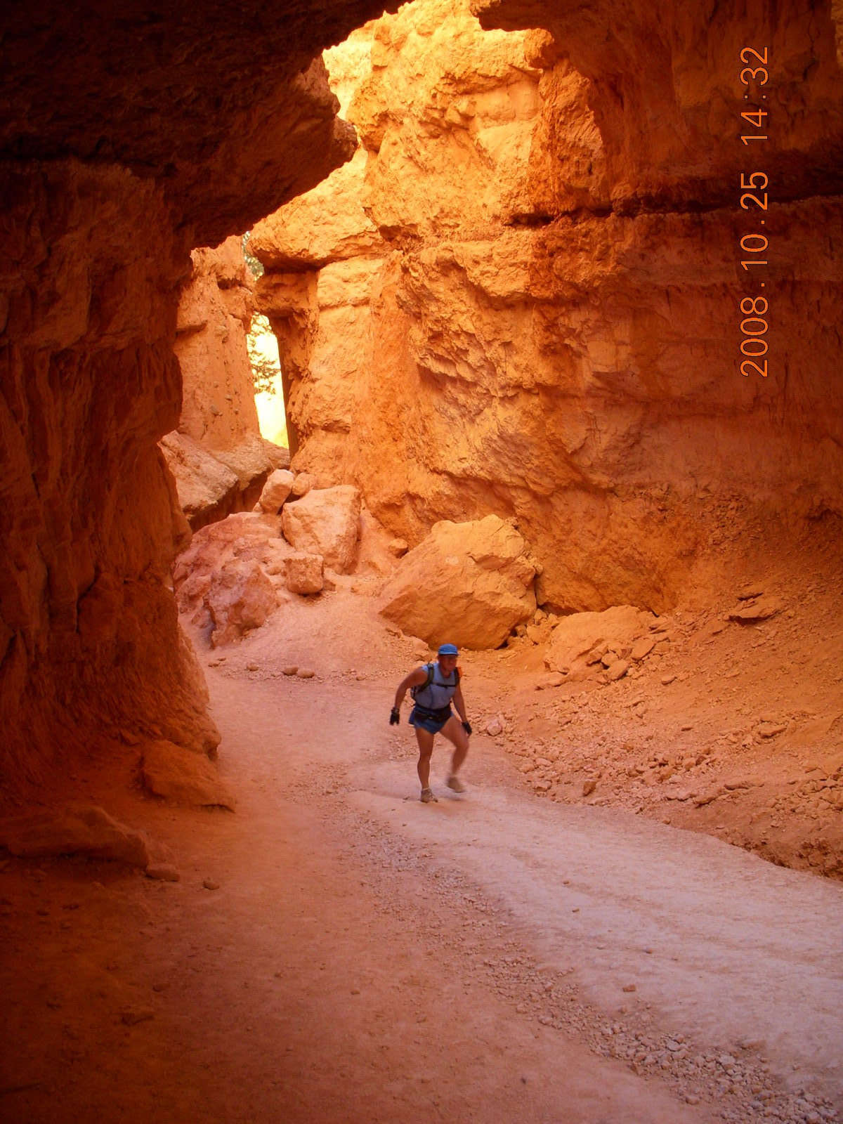
Hiking
 Bryce Canyon National Park is a day-hiker's paradise.
Arches has only one hike over three miles (5 Km)
while the Grand Canyon seems to specialize in
multi-day backpacking adventure treks.
I ran into some people who had visited Bryce Canyon before
but had only seen it from viewpoints and now they were hiking it.
I winked at them and said,
"Now that you've hiked it, you know the secret.
This is the way really to see the park.
The folks gawking at the rocks up there are weenies
missing out on the good stuff."
I said it tongue partway in cheek, but there's some truth there.
Bryce Canyon National Park is a day-hiker's paradise.
Arches has only one hike over three miles (5 Km)
while the Grand Canyon seems to specialize in
multi-day backpacking adventure treks.
I ran into some people who had visited Bryce Canyon before
but had only seen it from viewpoints and now they were hiking it.
I winked at them and said,
"Now that you've hiked it, you know the secret.
This is the way really to see the park.
The folks gawking at the rocks up there are weenies
missing out on the good stuff."
I said it tongue partway in cheek, but there's some truth there.
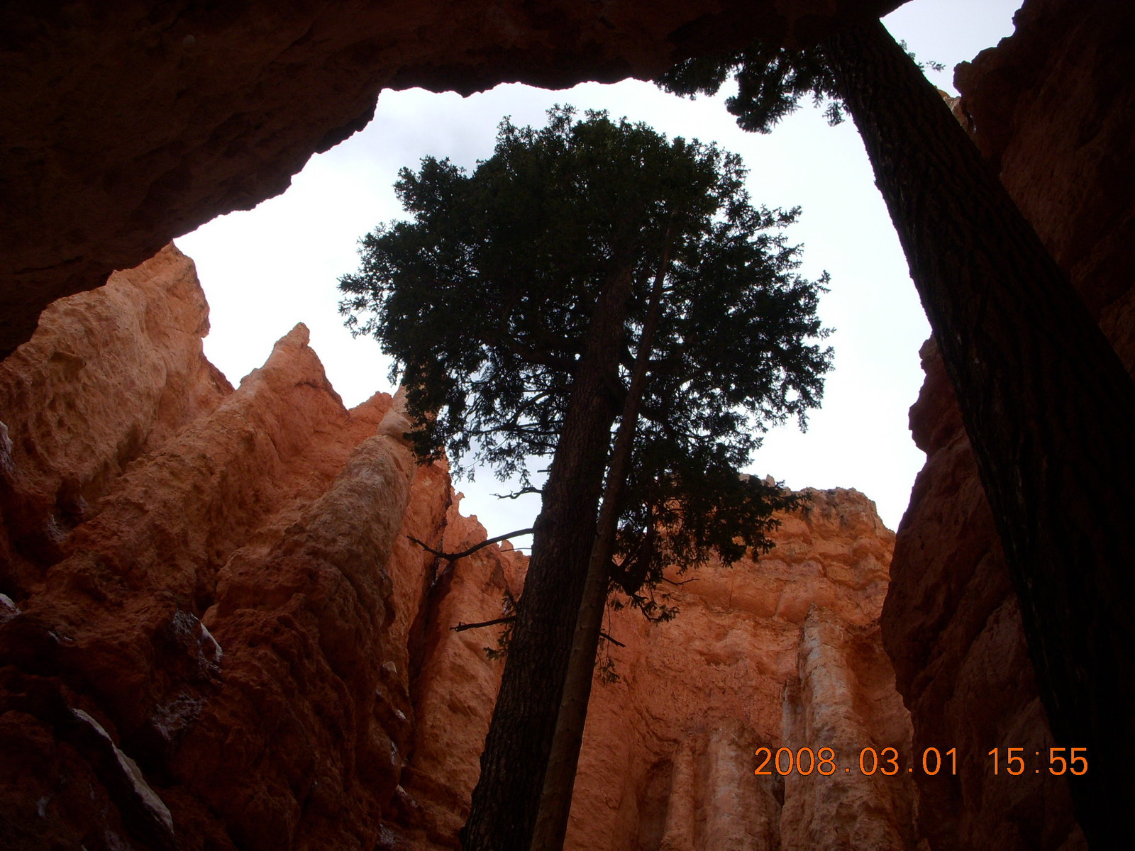
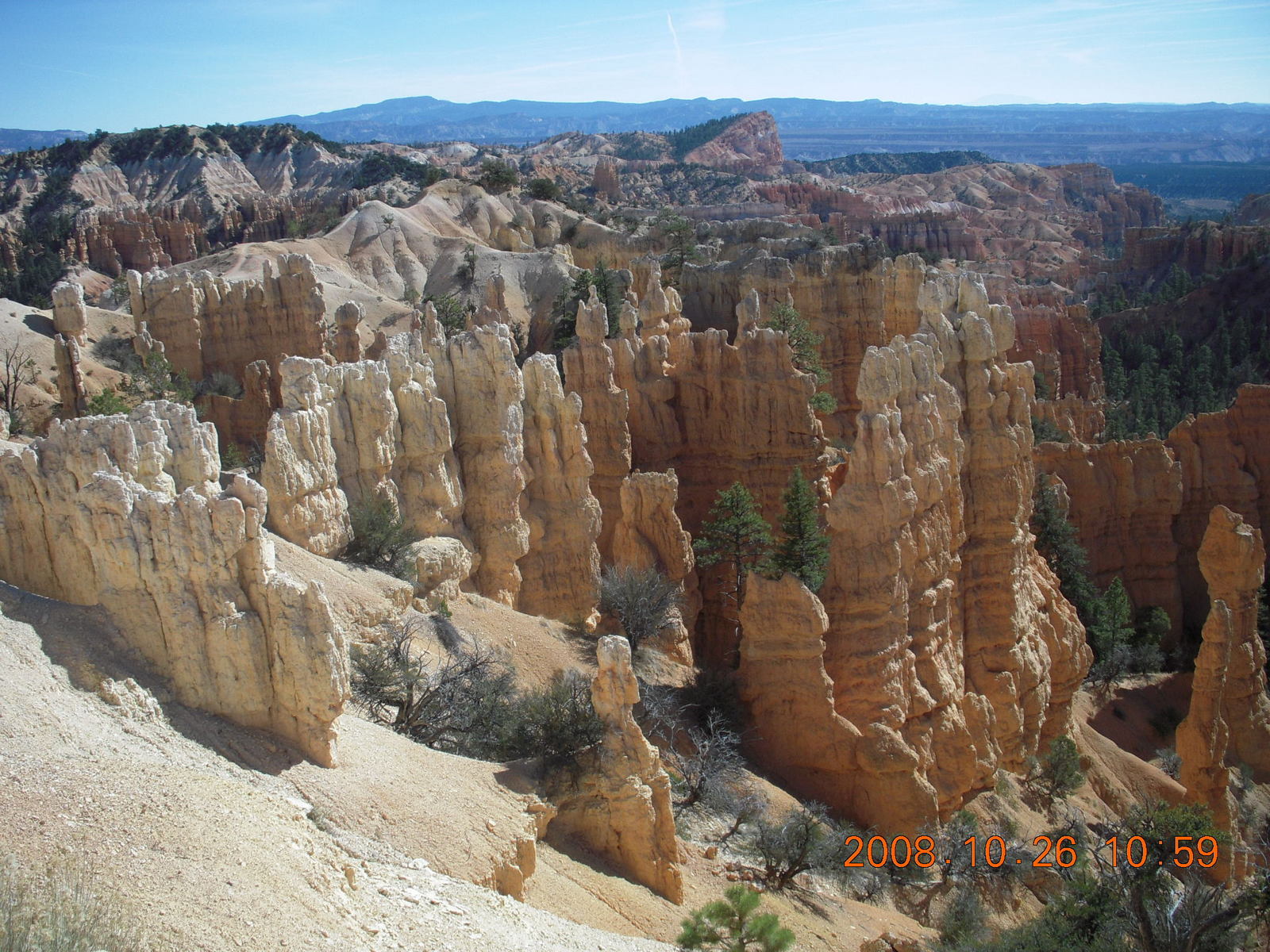
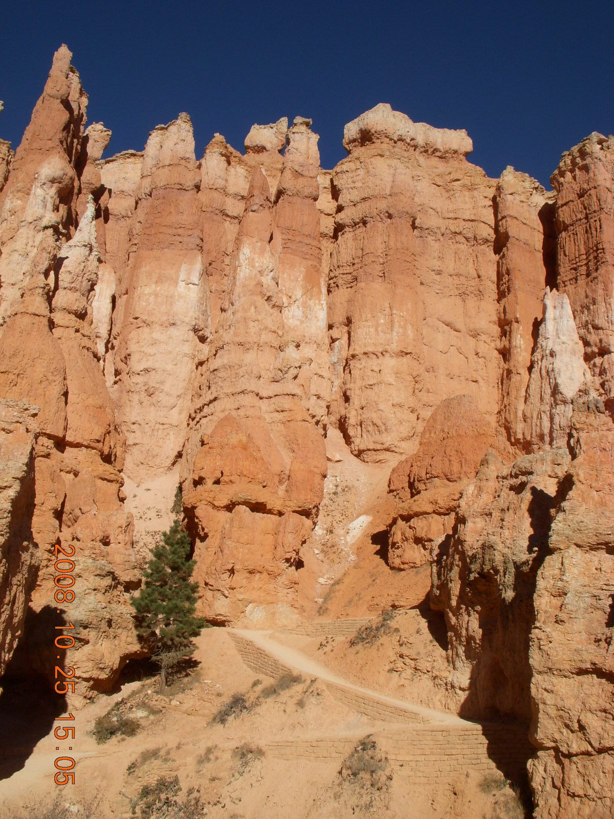
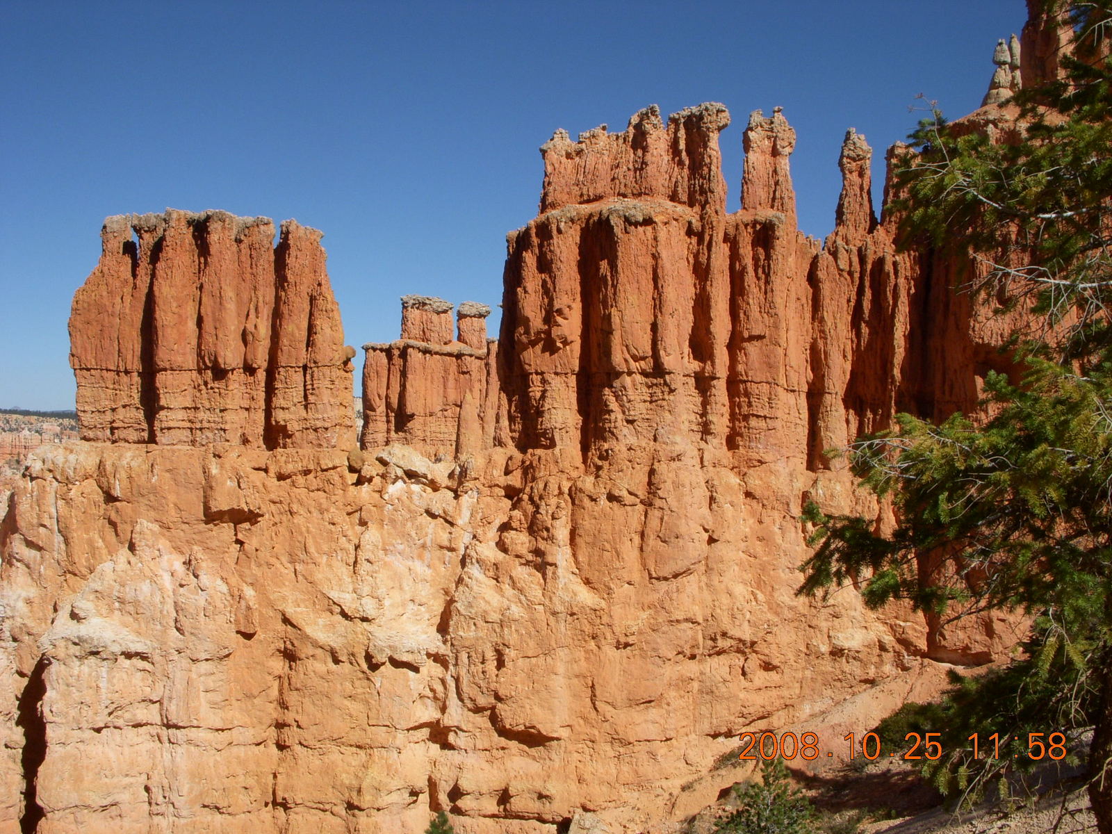
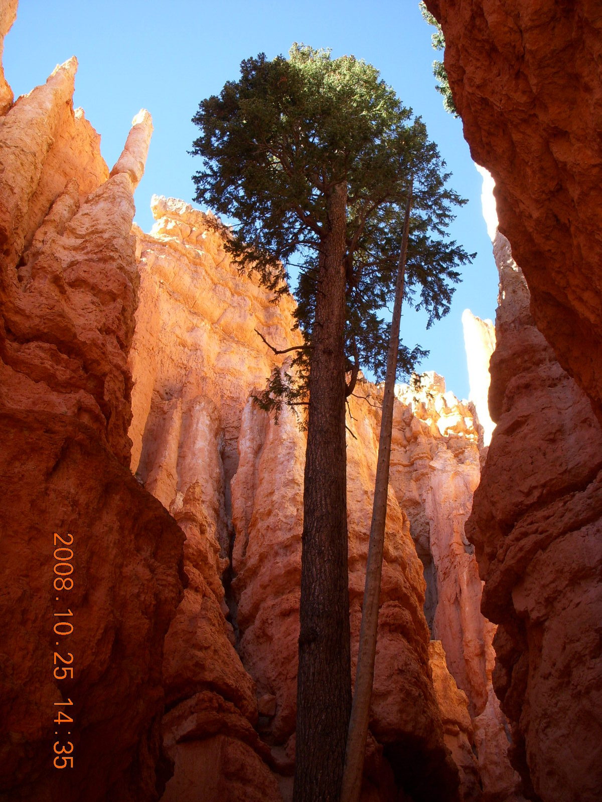
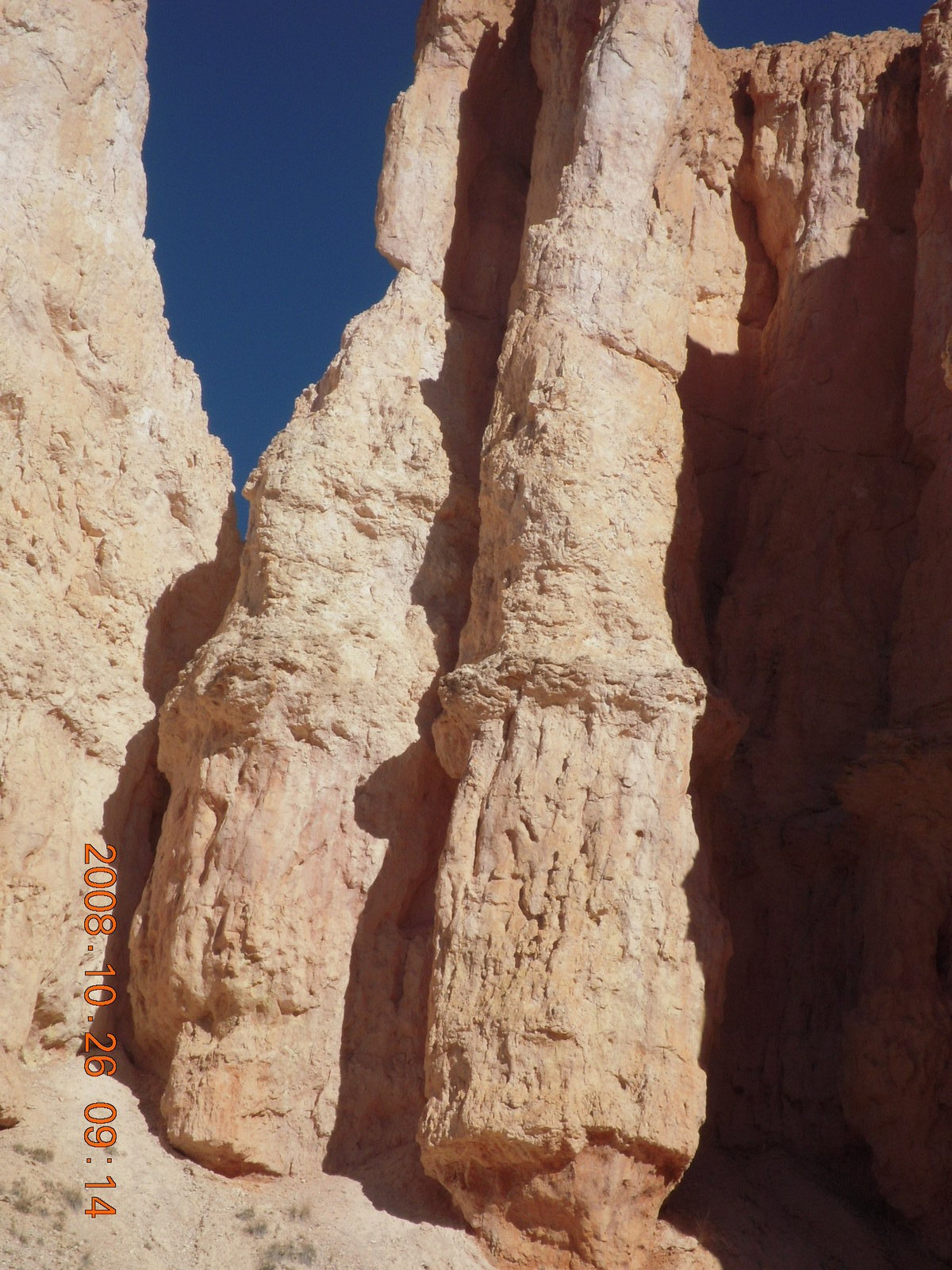
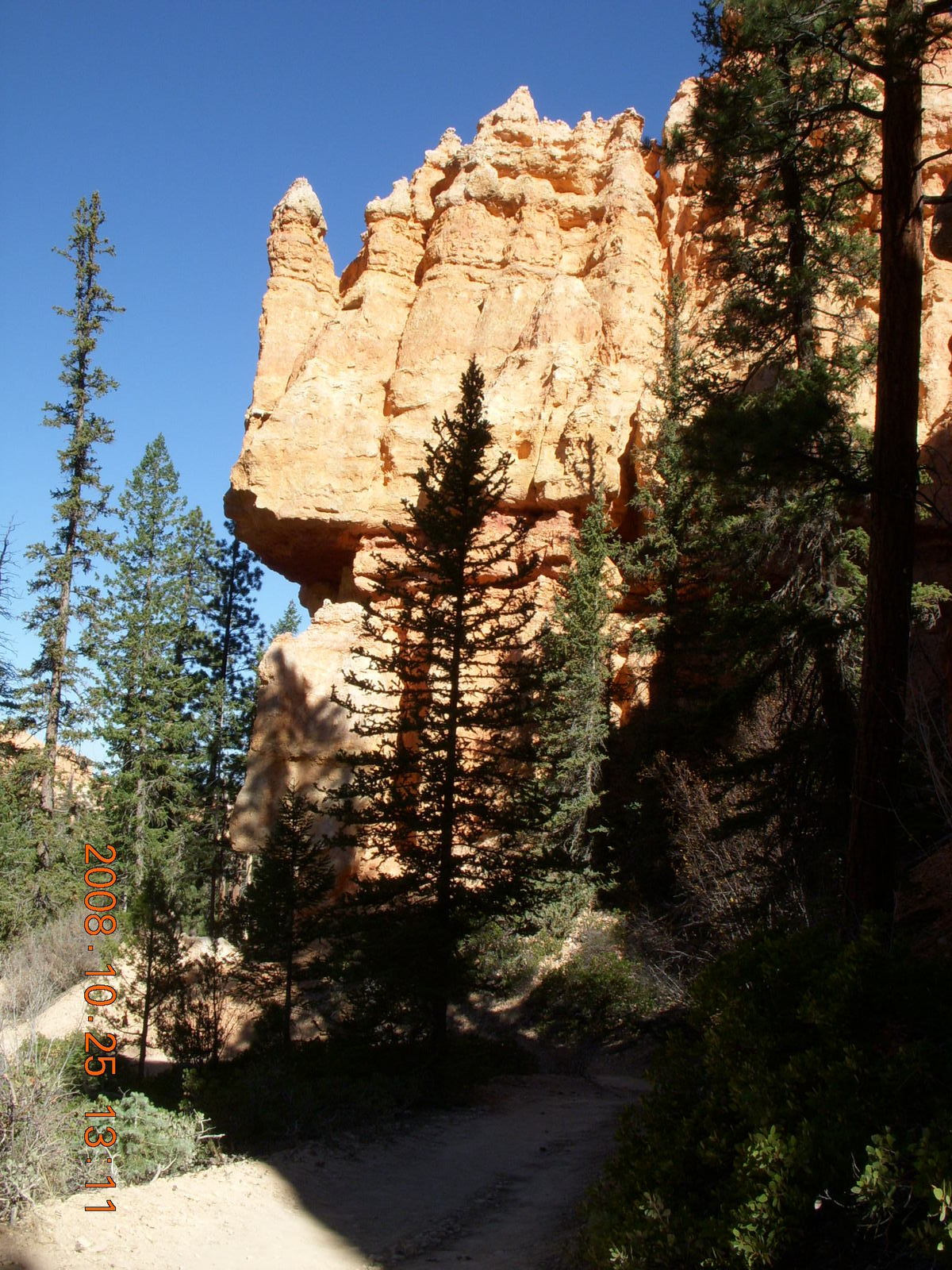 The shapes are also magnificent
with human-shaped "hoodoos" in rows and clusters
amid taller rocks of various shapes
and layers of hard and soft rock forming all kinds of formations.
The trails wind in and around these formations
so the hiker is immersed in the beauty.
Sometimes there are vista views below,
sometimes there are tall, towering forms above,
and often there are shapes all around at eye level.
Pine trees are all around to add an evergreen shade
to the myriad rock hues.
One can have all kinds of mystical revelations
at a place this beautiful,
a place that attracts people from all over the world.
My friends will tell you I'm not a religious person,
nor any kind of mystical person,
but I believe we can have sanctity without piety.
(Did I get my metaphysical and metaphorical terms right?)
Hearing Beethoven's "Appassionata" piano sonata,
seeing the female face painted by Leonardo,
being in the presence of the Taj Mahal,
or tasting a really fine wine
affirms to us that there are things so beautiful
that they deserve to be holy
even though theses examples are works of man rather than nature.
For each of these,
there was a morning when it didn't exist
and an afternoon it was here for all of us to enjoy,
perhaps with more than a few days in between.
The shapes are also magnificent
with human-shaped "hoodoos" in rows and clusters
amid taller rocks of various shapes
and layers of hard and soft rock forming all kinds of formations.
The trails wind in and around these formations
so the hiker is immersed in the beauty.
Sometimes there are vista views below,
sometimes there are tall, towering forms above,
and often there are shapes all around at eye level.
Pine trees are all around to add an evergreen shade
to the myriad rock hues.
One can have all kinds of mystical revelations
at a place this beautiful,
a place that attracts people from all over the world.
My friends will tell you I'm not a religious person,
nor any kind of mystical person,
but I believe we can have sanctity without piety.
(Did I get my metaphysical and metaphorical terms right?)
Hearing Beethoven's "Appassionata" piano sonata,
seeing the female face painted by Leonardo,
being in the presence of the Taj Mahal,
or tasting a really fine wine
affirms to us that there are things so beautiful
that they deserve to be holy
even though theses examples are works of man rather than nature.
For each of these,
there was a morning when it didn't exist
and an afternoon it was here for all of us to enjoy,
perhaps with more than a few days in between.
 Similarly,
the American southwest has many places beautiful enough
that they deserve to be holy.
Bryce Canyon is one of them,
perhaps the holiest of all of them.
Its beauty is really within us and our ability to perceive it.
The ancients said that bad people were turned to stone
to spend eternity there,
but I don't believe the gods would allow bad people
to spend eternity in such a beautiful place.
Instead this hiker chooses to believe,
at least for the duration of my joyous jaunt,
that when the purest and truest souls die,
they can become hoodoos in this wonderful place
to spend their eternity amidst its beauty.
Similarly,
the American southwest has many places beautiful enough
that they deserve to be holy.
Bryce Canyon is one of them,
perhaps the holiest of all of them.
Its beauty is really within us and our ability to perceive it.
The ancients said that bad people were turned to stone
to spend eternity there,
but I don't believe the gods would allow bad people
to spend eternity in such a beautiful place.
Instead this hiker chooses to believe,
at least for the duration of my joyous jaunt,
that when the purest and truest souls die,
they can become hoodoos in this wonderful place
to spend their eternity amidst its beauty.
 I have my hoodoo picked out in case I earn it
and the gods are nice enough to give me a choice
where to spend my eternity.
(What the hell?
It's no sillier than the official religions
and it's a lot better way to spend eternity
than most of their afterlives.)
I can go back to my old-testiment view
that life truly ends with death when I leave this place.
I have my hoodoo picked out in case I earn it
and the gods are nice enough to give me a choice
where to spend my eternity.
(What the hell?
It's no sillier than the official religions
and it's a lot better way to spend eternity
than most of their afterlives.)
I can go back to my old-testiment view
that life truly ends with death when I leave this place.
 I would love to say I never got tired this trip,
but I had to work hard to enjoy the pedestrian part of my vacation.
Part of the adventure is the challenge and the fatigue,
so I wasn't disappointed.
I was glad I didn't get tired to the point of exhaustion
where I wouldn't be able to enjoy the scenery and the mood.
The advantage of being an endurance athlete,
albeit a slow one,
is that I can endure.
I could keep moving and keep enjoying the scenery all afternoon
and the next morning.
My major fatigue issue was my toes got a little sore,
no blisters, just a little sore,
going down the latter, later hills on Sunday morning.
I would love to say I never got tired this trip,
but I had to work hard to enjoy the pedestrian part of my vacation.
Part of the adventure is the challenge and the fatigue,
so I wasn't disappointed.
I was glad I didn't get tired to the point of exhaustion
where I wouldn't be able to enjoy the scenery and the mood.
The advantage of being an endurance athlete,
albeit a slow one,
is that I can endure.
I could keep moving and keep enjoying the scenery all afternoon
and the next morning.
My major fatigue issue was my toes got a little sore,
no blisters, just a little sore,
going down the latter, later hills on Sunday morning.
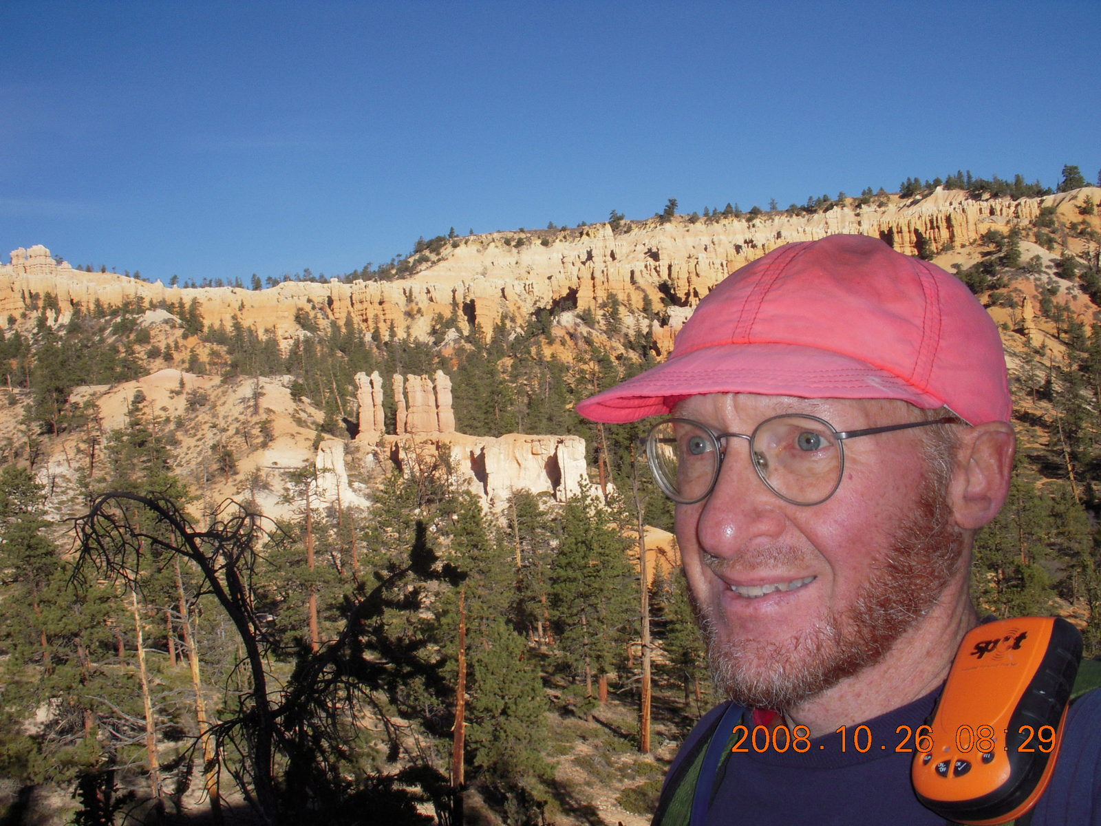
 Saturday afternoon I started at Sunrise Point
where I got one of the last, and farthest, spaces
in the parking area.
One of my issues in planning these trips is crowds.
I like people and friends,
I like nature and beauty,
but I usually don't like them at the same time.
The window between summer crowds and winter snow
at Bryce Canyon is narrow.
So I ran into people along the trails,
enough to be friendly,
not so many to feel crowded.
Most of the time I was alone but there was a friendly face
often enough to smile and to share the beauty of the place.
There were no screaming children and
there was one group of three loud-talking guys
who passed by me, stopped while I passed by them,
and seemed content to stay where they were
so I didn't hear them again.
Saturday afternoon I started at Sunrise Point
where I got one of the last, and farthest, spaces
in the parking area.
One of my issues in planning these trips is crowds.
I like people and friends,
I like nature and beauty,
but I usually don't like them at the same time.
The window between summer crowds and winter snow
at Bryce Canyon is narrow.
So I ran into people along the trails,
enough to be friendly,
not so many to feel crowded.
Most of the time I was alone but there was a friendly face
often enough to smile and to share the beauty of the place.
There were no screaming children and
there was one group of three loud-talking guys
who passed by me, stopped while I passed by them,
and seemed content to stay where they were
so I didn't hear them again.
 I left Sunrise Point along the Queens Garden trail
down through all the weird formations to level crossover trails
that are mostly trees with rocks in the background.
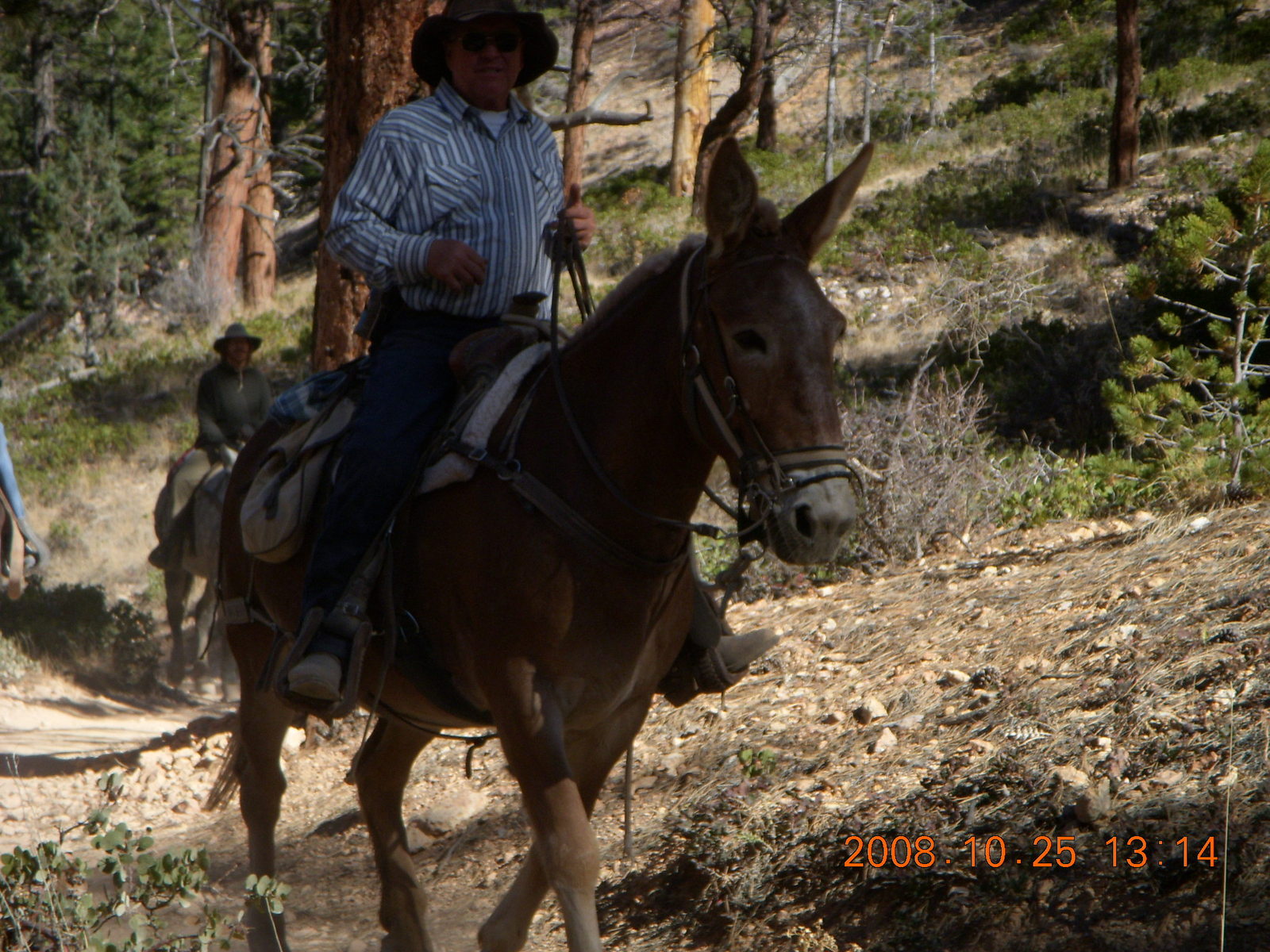
Those trails took me to the Peek-A-Boo horse-trail loop
which has the wildest views and tough hills to earn them.
At the far point of Peek-A-Boo is a tough climb
to the zenith of my hiking at Bryce Point
where I glanced at the vista view of the amphitheater
and turned back to other side of the Peek-A-Boo loop.
I left Sunrise Point along the Queens Garden trail
down through all the weird formations to level crossover trails
that are mostly trees with rocks in the background.
Those trails took me to the Peek-A-Boo horse-trail loop
which has the wildest views and tough hills to earn them.
At the far point of Peek-A-Boo is a tough climb
to the zenith of my hiking at Bryce Point
where I glanced at the vista view of the amphitheater
and turned back to other side of the Peek-A-Boo loop.
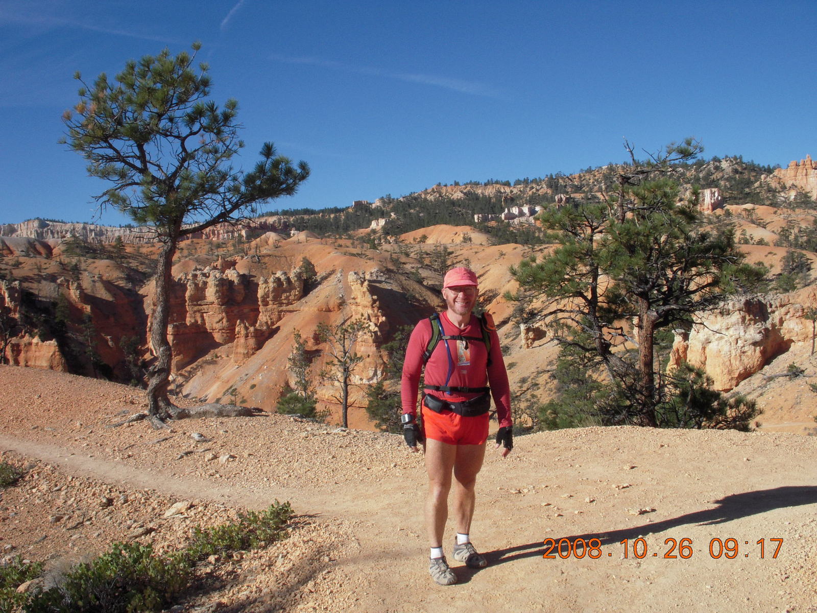
 Sunday's journey is at the north end of the park near the entrance.
It's the Fairyland loop
that includes the rim trail from Fairyland viewpoint
to Sunrise Point,
the Tower Bridge trail down from there to a natural bridge
in the rock that looks a whole lot like London's Tower Bridge,
and the Fairyland trail back up to the Fairyland viewpoint.
Sunday's journey is at the north end of the park near the entrance.
It's the Fairyland loop
that includes the rim trail from Fairyland viewpoint
to Sunrise Point,
the Tower Bridge trail down from there to a natural bridge
in the rock that looks a whole lot like London's Tower Bridge,
and the Fairyland trail back up to the Fairyland viewpoint.
 The remaining 6 Km (four-miles) goes up and down
and around Boat Mesa,
a multi-level, multi-colored hoodoo conglomeration
that looks like a boat from almost any angle.
The path goes right past the bow of Boat Mesa
and the view commands attention.
Not too long into this part of the hike,
the last long-sleeve shirt goes into my pack
and I'm down to my usual shorts and sleeveless top
with matching headband and cap.
The remaining 6 Km (four-miles) goes up and down
and around Boat Mesa,
a multi-level, multi-colored hoodoo conglomeration
that looks like a boat from almost any angle.
The path goes right past the bow of Boat Mesa
and the view commands attention.
Not too long into this part of the hike,
the last long-sleeve shirt goes into my pack
and I'm down to my usual shorts and sleeveless top
with matching headband and cap.
 Sometimes I think life is like the computer game Adventure
that spawned so many virtual-reality games like it.
You know,
you pick up the batteries and lamp to light your way,
you pick up the key so you can open the lock,
and you pick up the cage so you can catch the bird
who fetches the wand from the crack in the rock.
If you get all the right stuff,
maybe in the right order,
then you can make it home and win the game.
In my travel reality
I picked up a sewing kit from a hotel in Las Vegas
only to find I needed it to repair my travel pack in Jiuquan.
Sometimes I think life is like the computer game Adventure
that spawned so many virtual-reality games like it.
You know,
you pick up the batteries and lamp to light your way,
you pick up the key so you can open the lock,
and you pick up the cage so you can catch the bird
who fetches the wand from the crack in the rock.
If you get all the right stuff,
maybe in the right order,
then you can make it home and win the game.
In my travel reality
I picked up a sewing kit from a hotel in Las Vegas
only to find I needed it to repair my travel pack in Jiuquan.
Night
 When I got done with Saturday's amphitheater hike,
I drove to the south end of the park
for my vista-viewpoints tour.
Since all the views are east and we drive on the right here,
the best strategy is drive to the south end
and stop at all the viewpoints on the way back north
to the park exit.
At the very south is Yovimpa Point
with a view into the mysterious Utah landscape,
less mysterious to those who fly over it,
but still wonderful.
The stroll on the Bristlecone loop trail
between the two viewpoints here was my last hiking
on Saturday.
When I got done with Saturday's amphitheater hike,
I drove to the south end of the park
for my vista-viewpoints tour.
Since all the views are east and we drive on the right here,
the best strategy is drive to the south end
and stop at all the viewpoints on the way back north
to the park exit.
At the very south is Yovimpa Point
with a view into the mysterious Utah landscape,
less mysterious to those who fly over it,
but still wonderful.
The stroll on the Bristlecone loop trail
between the two viewpoints here was my last hiking
on Saturday.
|
|
|
Discussion was appreciative and a little scientific rather than political, even with the upcoming election. One fellow asked why night was night, not the stupid question of why one side of our planet faces away from the sun but why the sky isn't filled evenly with starlight in every direction. In the evolution of cosmology (this coming from a non-astronomer), the first realization is that an infinite, steady-state universe would have uniform starlight in every direction. That our night sky is mostly dark means our universe has some universal scace-time structure, either it's expanding in some way or it began some finite time ago. At the moment, my cosmology friends tell me both are believed to be true.
We got in our cars, turned on our headlights (ouch! too bright!), and drove to our respective dinners.
The hotel restaurant had a line going forever. I walked over and said "hi" to Paul Cox who is still flying helicopter tours in the park after thirty-six years. "Someday I may have to get a real job." Don't hurry, Paul, your tours are wonderful. I enjoyed them very much before I flew my own airplane here. He suggested dining in town where I had a wonderful trout dinner with soup and vegetables.
For those who live in or near Scottsdale, Arizona,
I have a couple of local plugs.
(Does anybody else read these pages I write?
Not if you believe the visit counts on the bottom.)
First, these concerts are part of the
Scottsdale Center for the Performing Arts.
They have a fantastic program year after year
attracting amazing breadth and depth of talent
into their intimate concert hall setting.
Second, for those who don't want to fly three hours each way, the
McDowell-Sonoran Conservancy
has a terrific set of trails,
terrifically presented and maintained
with terrific vista views and great people
right here in Scottsdale.
How often do you have two days where everything goes right?
No muss, no fuss, no foibles, no gripes, no complaints.
Flight, hikes, vista views, star-gazing, and music all were good.
Music
 After my flight home my travel experience was over,
but not my wonderful weekend where everything went right.
I drove home, relaxed, ate, showered, and dressed
for a concert Sunday evening.
Michael Kim
played a piano recital
of Mozart, Chopin, and Mussorgsky
in downtown Scottsdale.
Since the main auditorium of
the Scottsdale Center for the Arts
is being renovated this year,
concerts are being held in various other places.
This one was at a sub-basement venue called 4301
(at 4301 North Scottsdale Road)
which was small, intimate, and friendly.
This allowed Mr. Kim to play some of the Mozart
with harpsichord-like delicacy
that would not have worked in the larger hall.
After my flight home my travel experience was over,
but not my wonderful weekend where everything went right.
I drove home, relaxed, ate, showered, and dressed
for a concert Sunday evening.
Michael Kim
played a piano recital
of Mozart, Chopin, and Mussorgsky
in downtown Scottsdale.
Since the main auditorium of
the Scottsdale Center for the Arts
is being renovated this year,
concerts are being held in various other places.
This one was at a sub-basement venue called 4301
(at 4301 North Scottsdale Road)
which was small, intimate, and friendly.
This allowed Mr. Kim to play some of the Mozart
with harpsichord-like delicacy
that would not have worked in the larger hall.
 The second half of the concert was
a wonderful and personal piano performance
of
"Pictures at an Exhibition" by Mussorgsky,
the piano-only version before Ravel orchestrated it.
Having a single artist playing a single instrument
allows a flexibility not easily available
to an entire symphony orchestra
and Mr. Kim didn't waste it.
One of my friends says musicians used to play
with a lot more original flair and color
before they all heard the same recordings of the same masters
playing our favorite pieces.
This performance reminded me of that,
lots of timing flourishes and pregnant pauses
that made me feel that goblins were going to jump out of the canvas.
Much of the music sent me into raptures
visualizing the beautiful place
I had been hiking a few hours earlier.
The second half of the concert was
a wonderful and personal piano performance
of
"Pictures at an Exhibition" by Mussorgsky,
the piano-only version before Ravel orchestrated it.
Having a single artist playing a single instrument
allows a flexibility not easily available
to an entire symphony orchestra
and Mr. Kim didn't waste it.
One of my friends says musicians used to play
with a lot more original flair and color
before they all heard the same recordings of the same masters
playing our favorite pieces.
This performance reminded me of that,
lots of timing flourishes and pregnant pauses
that made me feel that goblins were going to jump out of the canvas.
Much of the music sent me into raptures
visualizing the beautiful place
I had been hiking a few hours earlier.
 Many of my recent concert experiences
have been tainted by a steady stream of audience chatter.
I'm not sure what people think when they whisper loudly enough
for their neighbors to hear what they're saying over the music,
but if their neighbors can hear them, then I can hear them, too.
Leopold Stokowski once said,
"A painter paints his pictures on canvas.
But musicians paint their pictures on silence.
We provide the music, and you provide the silence."
My concert experience was totally free of noisy conversation clutter
while the intimate setting allowed musician and audience
to communicate perfectly.
The evening's music was a complete joy to me,
a perfect encore for my trip.
Many of my recent concert experiences
have been tainted by a steady stream of audience chatter.
I'm not sure what people think when they whisper loudly enough
for their neighbors to hear what they're saying over the music,
but if their neighbors can hear them, then I can hear them, too.
Leopold Stokowski once said,
"A painter paints his pictures on canvas.
But musicians paint their pictures on silence.
We provide the music, and you provide the silence."
My concert experience was totally free of noisy conversation clutter
while the intimate setting allowed musician and audience
to communicate perfectly.
The evening's music was a complete joy to me,
a perfect encore for my trip.
23:10:29 Mountain Standard Time
(MST).
664 visits to this web page.